

Arthur became the first Hurricane of the Atlantic season early Thursday morning. The storm had 80 mph maximum sustained winds at 8 am Thursday, and it is turning north-northeast at around 10 mph while heading for the Outer Banks of North Carolina. The storm is expected to skirt the Outer Banks Thursday night as a strong category one hurricane before turning northeast and moving into the Atlantic Ocean passing southeast of Nantucket Friday night.
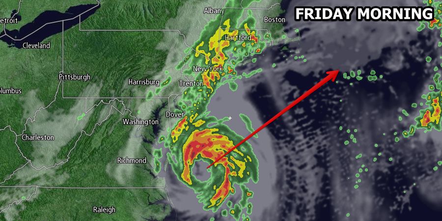
The main threat from Arthur in Southern New England continues to be for heavy rain as the storm interacts with a stalled cold front draped over the region. The front will help to steer Arthur east of New England, but it will also serve as a focal point for tapping into some of the moisture from Arthur and producing locally heavy showers and thunderstorms on the 4th of July.
Rain should develop from west to east in Southern New England on Friday. The day may be showery from start to end in CT, with rain developing during the mid to late morning in RI, and rain steadiest in the afternoon in SE MA. It will be very humid, with temperatures ranging from the mid 70s to low 80s by midday, then falling through the 70s in the afternoon as the wind swings around to the east-northeast.
Rain, heavy at times, will continue in the evening. The heaviest rain will shift into SE MA during the mid to late evening. Rain will end after midnight in RI, and before dawn in SE MA. Widespread 1-3″ rain totals are expected, and the hardest hit areas may see 4-5″. Localized street flooding is possible.
Winds will pick up near the RI coast and Buzzards Bay to 15-25 mph Friday night, but damaging winds are not expected. Some 30-40 mph wind gusts are possible on Cape Cod Friday night. Nantucket may see wind gusts over 40 mph if the storm is still packing maximum sustained winds over hurricane strength.
High surf and rough seas are likely along the Southern New England coast into the weekend. Seas will be 4-6 ft. at the entrance to the bay on Saturday, and offshore seas of 6-10 feet are possible. Area beaches will have moderate to high rip current risks and the potential for 3-5 foot surf.
The weather will improve dramatically on Saturday. It will be breezy and dry, with sunshine and highs in the upper 70s to low 80s. Sunday looks warm and sunny, with highs in the low to mid 80s.