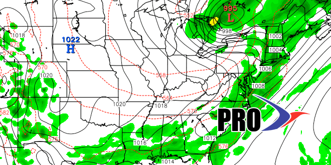
The weather will stay quiet through the weekend in Southern New England before the action really picks up early next week. As we mentioned on Monday’s Long-Range Forecast, there will be an anomalously strong trough diving into the central United States early next week. Southern New England will be on the warm, humid, and unsettled end of that system. There is a widespread shower and thunderstorm threat from Sunday night through Wednesday midday. It will certainly not be raining the whole time, but lines of showers/storms will likely make multiple passes through Southern New England in those 60 hours. It will be very humid, and highs will be in the 80s inland if there is sunshine. Lows will be near 70. So, while not overly hot, you’ll probably be running the A/C.
The Storm Prediction Center is watching this stormy pattern for potentially severe weather. It cannot be ruled out – especially Tuesday and/or Wednesday. An early estimate is for more than an inch of rain for all of Southern New England, with the potential for 2-4″ and some flash flooding if this system lives up to its potential.
It looks like drier and seasonable weather will return late Wednesday or Thursday, and last into next weekend. The pattern does not look as unsettled in the following week, but more showers are possible from time to time as cold fronts approach from the west. It does not look like there will be too much, if any, extreme heat (mid 90s inland) in the next couple of weeks. Last July, there eight days in the mid to upper 90s before the 20th. This year, there may be none.
