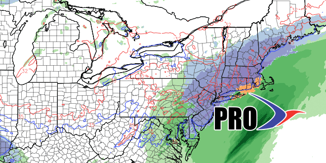
We will be keeping track of the latest computer model information for the pending midweek storm on this page. It’s a live blog and will be updated throughout the day. This is a very close call between snow and rain for the area from Worcester to the I-95 corridor. South and east of the I-95 corridor, it still looks like a mainly or all rain event.
Computer Model Trends: November 24