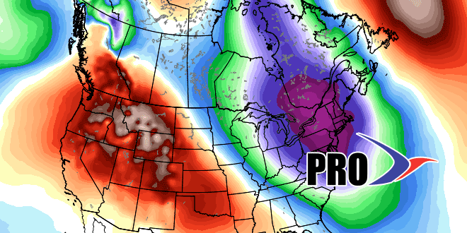
We see no reason to change our view that there will be many chances for snow in the next two to three weeks in Southeastern New England. It remains to be seen if it will become the kind of hyper-active pattern that we’ve seen in February and/or March for the past couple of years, but it looks a lot more like winter than the pattern we saw for December and part of January. Not every storm (see Saturday) is going to deliver on its full potential for snow, but, for snow-lovers (of which there are many and they tend to make the most noise) at least we are talking about the possibility of snow where that was not even discussed in most of December and early January.
The pattern has a high potential for storminess, but it is more of a lock for cold weather. There is not much doubt that there will be ample cold air around, and possibly some extremely frigid outbreaks in the next two to three weeks. That’s not great news for our heating bills, but, at least the cost of oil is lower than in many recent winters.
Specifically, we’re watching a storm threat early next week. It would be all snow, but it’s unclear if the system will pass to far south and east to bring accumulating snow or if there will be several inches of fluff. The timing is Monday into Monday night. There will probably be a dry and very cold midweek. Further down the road, the northern branch of the jet stream will probably be active, and if some of the energy phases with the southern branch, then potentially big East Coast storms could be on the table. As stated earlier, it’s not a lock, but it’s not like it was earlier in the winter when we were saying there’s no chance of it happening.
A long video below with lots of interesting graphics!
