If you’re a winter weather lover, then you best savor this pattern because you may not see another one like for a long time. Boston is well on its way to smashing a record that I thought I would never see broken. 1995-96 is the benchmark for snowfall in Southern New England with 105+” in Boston and Providence. Boston is closing in on 80″ and with storms lining up, they may break the record before February 20th! Providence is not even halfway to the record, but the second highest season snow total on record is 30.5″ less than the epic 106.1″ in 1995-96. Providence may make a strong run at the second snowiest winter since 1905. That, too, could happen before February ends!
We are, of course, looking at a potentially big storm this weekend. It will be followed by a bitter blast early next week, and then a southern streamer that could bring another substantial snow Tuesday night through Wednesday. That storm is trending south, but still comes close enough for mixing issues near the south. If it continues trending south, it may become more of a glancing blow. That cannot be ruled out, at this point.
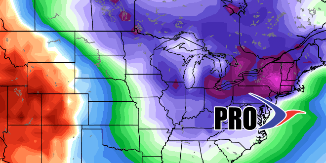
It will get cold and dry again late next week. The models are hinting at another storm sometime around February 22-24, and when looking at the longer range, the hits keep coming right through the end of February into early March. The temperature will be running extremely cold for February, and this should be a top-5 coldest February on record in Southeastern New England.
What more is there to say?


