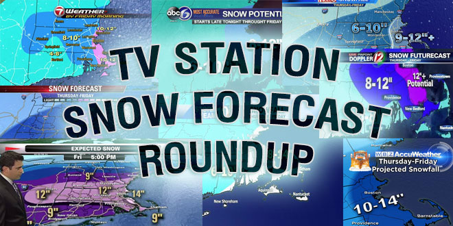
Round ’em up! Here are the projections for Monday’s storm from a variety of media outlets including many Southern New England television stations. The storm will be a close call between snow and mixed precipitation in coastal Southern New England, and that may lead to some different forecasts.
Bright, cold day on tap…then there's Monday. And snow. Starts 2-4am ton. tapers 4-5pm Mon. pic.twitter.com/YpyJGtRcAa
— Pete Bouchard NBC10 Boston (@PeteNBCBoston) February 1, 2015
A major winter storm will impact SNE later tonight into Mon evening. Here are the details. pic.twitter.com/XIHS5TtyJX
— NWS Boston (@NWSBoston) February 1, 2015
Every Storm Is Different & The Upcoming Version Will Feature The Fluffiest Snow North & West With A Wetter Snow South pic.twitter.com/XHAlQFLnGh
— Barry Burbank (@BarryWBZ) January 31, 2015
No one in our camp is surprised by expanding snow map right?
Welcome to the 12"+ club Northern New England pic.twitter.com/mw5i614zTT— Tim Kelley NBC10 Boston (@TimNBCBoston) February 1, 2015
Holding steady on my accum map. If you asked me to put a number on Providence, I'd say 9". pic.twitter.com/hDBBprO86s
— T.J. Del Santo ⚡🔭 (@tjdelsanto) February 1, 2015
Fcst is complex for tom, need a vlog, not 140 characters! Here's best I can do w gfx…more to follow,hold caller… pic.twitter.com/f1Yn2DbnYz
— Stephanie Abrams (@StephanieAbrams) February 1, 2015
Nasty day coming up on Monday with snow, sleet, ice, rain, wind…all the fixins’ http://t.co/FToaHdmkLA pic.twitter.com/5b0mrnzyVX
— Phil Burt – CapeCodWeather.Net (@capecodweather) February 1, 2015
Our thinking has not changed.Mixing may keep us on the lower end of the scale.Still a high impact storm #FirstAlertCT pic.twitter.com/zUmY2UMeyB
— Darren Sweeney NBCCT (@DarrenSweeney) February 1, 2015
*new* Latest snowfall forecast- big concerns over icing! #abc7ny @abc7ny Be careful tonight after the game! pic.twitter.com/rpXXPJRYS7
— Amy Freeze (@AmyFreeze) February 1, 2015
