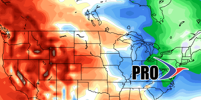
Barring an unforeseen warm-up, this is 2015 will have the coldest January-March stretch on record in the Providence area. This month is running nearly 6° colder than normal, and there is no sign of a warm-up in the next couple of weeks. It will be considerably colder than normal from Sunday through Tuesday, and only near normal on Wednesday and Thursday. Another cold shot arrives late next week and likely lasts through next weekend.
Precipitation-wise, there will be some light snow Friday afternoon and night before drier weather settles in on Saturday and lasts through the middle of next week. The milder weather Wednesday into Thursday comes with the threat of showers on Thursday as a cold front approaches. Looking further down the road, it is a “high potential” pattern in the end of March and early April. It will be unseasonably cold, and there should be some stormy weather near the Eastern Seaboard. It’s uncertain if that will translate to near-misses or storms that threaten with snow, mix, and rain well into the start of spring.
