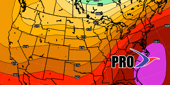
The Memorial Day weekend will begin with unseasonably cool weather, but do not expect it to last for long. A developing southwest breeze and ridge off the East Coast will lead to an extended stretch of very warm and muggy weather in Southern New England. The temperature could reach 90° inland as soon as Tuesday afternoon, and a heat wave away from the coast is not out of the question next week. There is not a very high potential for rain in this pattern. Thunderstorms are possible at times late next week, but it looks like most of the action will be west of Southeastern New England.
Overall, a warmer than normal pattern will hold through the end of May into early June. The ridge may break down bringing an end to the hot weather, but it looks like it will stay rather muggy, and overnight low temperatures will be well above normal most of the time after Memorial Day through the following week. The ocean temperature is slowly warming, but it may still be cool enough to allow for patchy dense fog at night that takes a while to burn off in the morning on some days. Check out the video for more on the upcoming pattern.
