Humidity will stay high into next week, and there is a general shower and thunderstorm threat that will also continue for several day. This unsettled pattern comes after a mainly dry stretch since August 11. By the end of the month, precipitation totals are likely to be pretty close to normal in the Providence area. The average temperature for the month will likely be the warmest (relative to normal) of the summer. So far, the temperature in Providence is running 1.6° above normal. It will likely be even further above normal by month’s end. June was a hair below normal, and July was 1° above normal.
A slow-moving system will deliver scattered showers and thunderstorms between Friday and Monday. It will not be raining the whole time, but there could be some heavy downpours because of the copious moisture over Southeastern New England. Highs will only be in the upper 70s to low 80s – not too far from normal. Lows, however, will be close to 70° – around 10° warmer than normal. Keep your eyes to the sky and on the radar this weekend if you have outdoor plans.
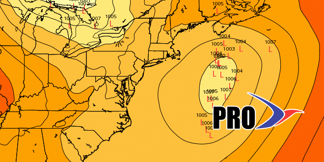
We’ll be watching an offshore storm this weekend. It may become a sub-tropical storm, but should stay far enough away that it only brings some rough surf to area beaches. If it manages to swing the wind around to the northeast, that will help to lower the humidity a bit, but it won’t be exactly dry, either.
The humidity will finally break in the middle of next week when the wind shifts to the west. That will likely happen on Wednesday. We’re looking at a dry and warm stretch to end August and start September. Looking at the pattern, more 90° heat is not out of the question. See the video for more.
