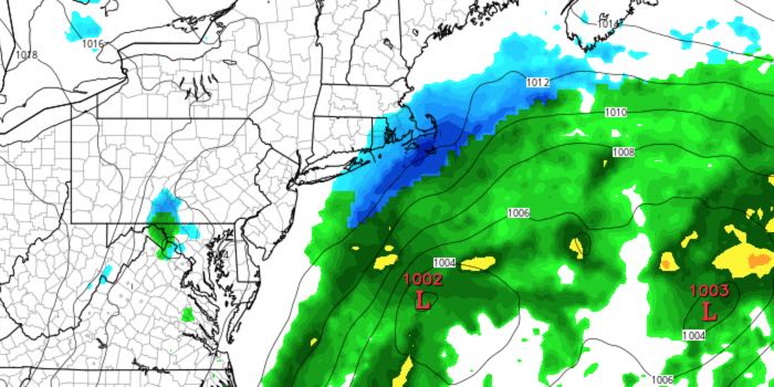
It looks like Southeastern New England will not receive a direct hit from a snowstorm passing southeast of Nantucket. The timing of the storm has shifted to mainly Sunday night, with the best chance of accumulating snow near the coast.
SATURDAY
Look for plenty of sunshine, but it will be on the cool side, with highs in the low to mid 40s. There will be a 10 mph northwest breeze. Saturday night looks mainly clear and cold.Lows will be in the mid to upper 20s.
SUNDAY
A partly cloudy morning will give way to a mostly cloudy afternoon. It will be breezy and cool, with highs in the mid to upper 30s. A few flurries are possible by late in the day.
SUNDAY NIGHT
Snow develops from south to north in the evening. The best chance of steady snow is at the coast and on Cape Cod and the islands. A slight southward shift in the storm’s track would prevent snow from reaching Southeastern New England entirely. It will be breezy, especially on Cape Cod and the islands where 25-30 mph gusts are possible.
MONDAY
Light snow may linger until 9-10 am in RI, and until around noon in SE MA. It is unlikely that the snow will stick after sunrise due to the high late-March sun angle. Skies will become partly sunny in the afternoon. Highs will be in the low 40s.
MIDWEEK
Mainly dry and seasonable weather is likely in the midweek. Tuesday looks partly cloudy with highs in the mid to upper 40s. Cloud will increase Wednesday, and a few showers are possible at night. Highs will be near 50 on Wednesday. Thursday’s forecast is tricky because a front may be just north or south of RI and SE MA. There will be a 10-20° temperature difference on either side of the front. Highs could be in the 40s or near 60 depending on where the front sets up. There is a better chance of being on the warm side of the front by late in the afternoon.
