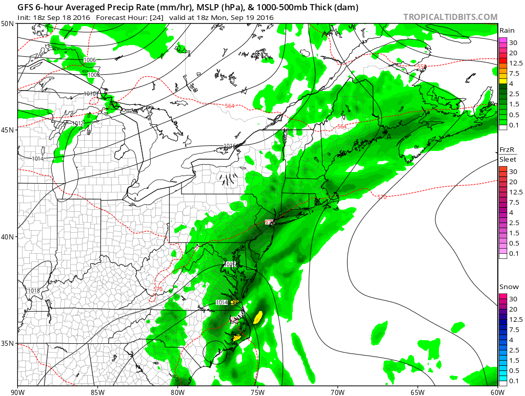
The first appreciable rain since September 1st is heading for Rhode Island and Southeastern Massachusetts. to start the workweek. Expect showers off and on through Monday into Monday night. Temperatures will be in the low 70s on Monday. The rain threat ends late Monday night, but not before most of the area should pick up 0.5-1″ rain.
Sun returns on Tuesday, and it will be warm for late-September. Highs will be near 80° – nearly 10° warmer than normal. It will stay warm through the midweek. Highs will be near 80° again on Wednesday. Quiet weather is likely on Thursday. An onshore breeze will likely keep temperatures in the 70s. The weather looks nice for Pats vs. Texans Thursday night. Fall arrives Thursday at 10:21 am.
The remains of Tropical Storm Julia will be spinning off the Southeastern US coast for most of this week. Late in the workweek, whatever is left of the storm may drift north to off the Mid-Atlantic coast. Right now, it looks like rain will stay south of Southern New England, but it bears watching for Friday. The forecast at this point is for partly cloudy and seasonably warm conditions.
A cold front will swing through Friday night, and much cooler weather is ahead for the weekend. You can expect dry and breezy conditions on Saturday. Highs will be in the low to mid 60s. Sunday may be even cooler with a northerly breeze and highs in the low 60s. Lows will be in the 40s to low 50s. Both days should be partly sunny.
