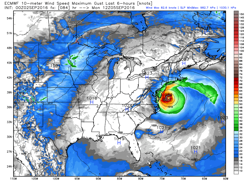
Our focus continues to be on Hermine and its potential impact in Southeastern New England. There have not been any major forecast changes since Thursday. The storm is likely to stall south of New England for a few days. We expect it to be far enough south that the biggest impact in RI and SE MA will be for mariners and a coastal battering of large waves and flooding during high tide cycles. The storm will probably come close enough for some showers, with the best chance of rain over the Labor Day weekend late Sunday into Monday morning.
I am still concerned about the storm making another run at Southeastern New England in the middle of next week before heading out to sea. Right now, it looks like it will slide out to sea without too much impact, but if it drifts a little farther north and the center passes near Nantucket then a rainy Nor’easter is possible. Check the Live Blog below for updates on Friday.
