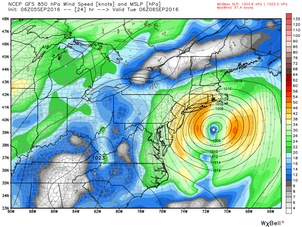
Post-Tropical Cyclone Hermine is moving north to deliver a glancing blow to Southeastern New England Monday and Tuesday. The storm will come close enough to bring tropical storm conditions to the islands, with less-windy conditions inland. Peak wind gusts over RI and Bristol, Plymouth Counties in Massachusetts will likely be around 40 mph.
There will be some showers moving in Monday afternoon/evening, and showery weather is likely through Tuesday as the storm lingers to the south of Block Island. While a drought-busting rain is not likely, a few spots could receive an inch of rain in the next couple of days.
The storm weakens and moves away from New England in the midweek, with some sunshine possible late Wednesday, and unseasonable warm weather to follow.
MONDAY
Cloudy, increasing wind, chance of rain in the afternoon, especially in SE MA. Winds 15-30 mph sustained, with peak gusts 40-45 mph possible, especially near the coast. Highs near 70.
MONDAY NIGHT
Cloudy, windy, some showers. Northeast winds 20-35 mph, with gusts to 40-45 mph possible. Windiest in the evening. Lows in the 60s.
TUESDAY
Mostly cloudy, scattered showers likely. 10-20 mph winds, with some gusts to 30 mph possible. Highs in the 70s.
WEDNESDAY
More clouds and scattered showers, still breezy with 10-20 mph winds, and a few 25-30 mph gusts. Wind diminishes late in the day, and skies may brighten. Upper 70s to low 80s.
Highs will be in the 80s late in the workweek into Saturday under partly cloudy skies. It may reach 90 inland one or two days. It will be muggy, with lows in the 60s to near 70.
