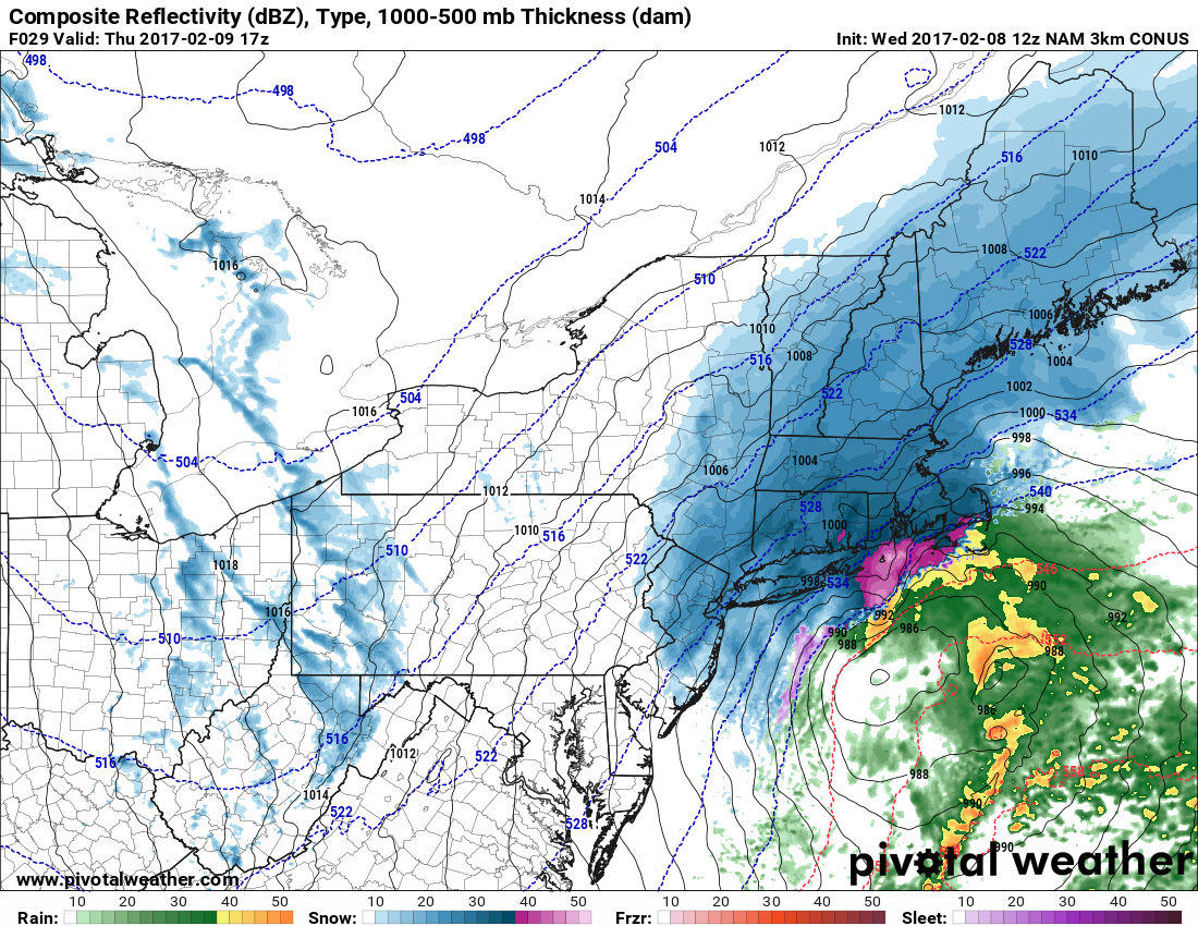
A high-impact snowstorm is imminent for Southeastern New England on Thursday. Odds of at least 6″ of snow are high, and, depending on how fluffy it is, some places could receive 12″ of snow in less than 12 hours. It will be windy near the coast, and very cold air follows the storm Thursday night.
Thursday looks like a “hunker down” kind of day where only necessary driving should be considered. It’s a no-brainer for school cancellations, even though it may not be snowing much before 8 am. Snow will develop from west to east between 6-9 am. The height of the storm is likely around midday, with 1-3″ snowfall rates possible. Snow will get lighter after 3 pm, and most likely end between 5-8 pm for all but Cape Cod and the island where it may linger until shortly after midnight.
This is the kind of storm that will make driving difficult, and snarl air travel at Northeast airports. Expect delays and cancellations.
It looks like a widespread 8-14″ in Southeastern New England with the best chance of 11-14″ inland where it may be fluffier as cold air arrives during the storm. The temperature will fall through the 20s from north to south during the day.
Winds will gust over 30 mph at the coast, with 40+ mph gusts possible on Cape Cod and the islands. Near-blizzard conditions are possible for a couple of hours at the height of the storm.
It will be windy and bitter cold Thursday night. Lows will be in the single digits to low teens with sub-zero wind chills. Highs will only be in the upper teens to mid 20s on Friday, even with some sunshine.
Another storm system will bring light snow, mix, and rain Friday night into Saturday. At this point, it does not look like more than 1-3″ of snow that could change to rain Saturday afternoon. I’ll turn my attention to that part of the forecast after Thursday.
