


The weather will be mostly warmer than normal in the next couple of weeks, but, it’s still February, and if a storm takes the right track it will bring snow. It looks like we’ll have one of those storms to deal with this weekend. It’s early, but a moderate snow event seems likely Saturday night into Sunday morning. In the meantime, expect it to be relatively warm for mid-February, and the warmth returns quickly late in the weekend into early next week.
Rain showers are likely late Wednesday night until around dawn on Thursday. The temperature will stay above freezing, so ice is not a concern. Clouds may be stubborn on Thursday, but it will be mild, with highs in the upper 40s to mid 50s. Another round of rain is likely late Thursday night with showers lingering through Friday morning. It will stay mild on Friday before turning colder on Saturday. Look for highs in the low 50s on Friday, and lows in the 20s Saturday morning.
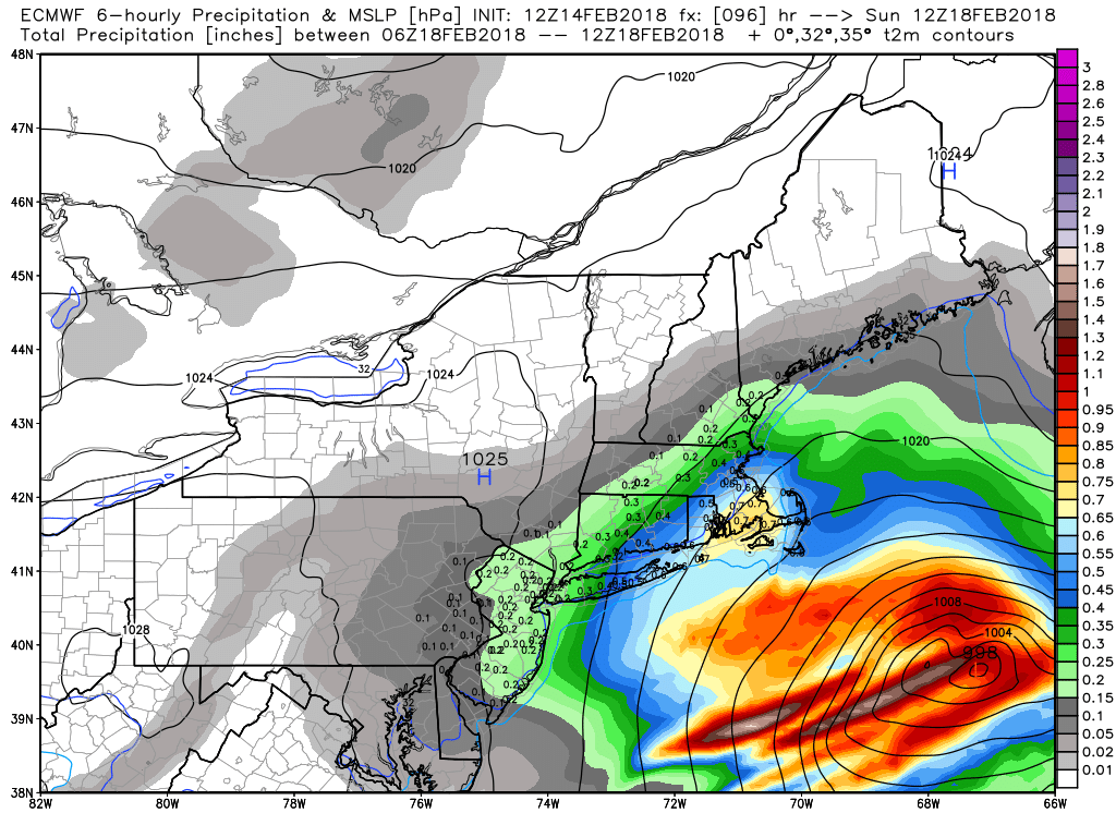
Clouds will increase Saturday afternoon. It likely stays dry through the day. A fast-moving storm will shoot off the Mid-Atlantic coast late Saturday. At this point, it looks like snow will overspread Southern New England Saturday evening, and continue through the night. The storm moves away early Sunday, but not before bringing accumulating snow to all of CT, RI and MA. This is all based on the current projected track, and a slight shift north or south is the difference between getting some mixed precipitation if it comes to close to the coast, and not getting much at all if it stays far enough south. It’s too early for a snowfall map, but this one has the potential to be a moderate snow event. An early, early estimate is 4-8″ of snow.
Any snow that falls will melt quickly in the days that follow. Highs will be well into the 40s Sunday and Monday. It should get even warmer in the middle of next week. Near-record warmth in the 60s is possible Tue-Thu. A southwest breeze will keep the coast cooler.