A second straight record warm day will be a fading memory by Thursday afternoon as chilly rain, sleet, and even some snow arrive in Southern New England. The best chance of a couple of inches of snow is along and north of the MA Pike. There may be a coating of snow, especially on the grass near the RI/MA and CT/MA borders. Sleet could drift all the way down into the Providence area during the afternoon. Temps will fall into the mid 30s during the day, with the steadiest precipitation in the afternoon and early evening.
It will be near freezing Thursday night, so watch out for a few slippery spots. Friday looks raw and unsettled, with the best chance of rain in the afternoon and evening. Highs will only be near 40. Saturday is the better weekend day. Expect a lot of clouds, but it should reach the 50s and stay dry or mainly dry through the day. Rain returns for Sunday with highs in the 40s. If you think we’ve had a lot of unsettled weekends, you’re right!
The weather looks dry and mild or seasonable into the middle of next week. Showers may arrive on Wednesday. A weather pattern change is likely late next week. The North Atlantic Oscillation will go strongly negative, and that means it will likely be cooler, and potentially unsettled in early March. It’s very likely that there will be a storm or series of storms in the Atlantic Ocean in early March. There is still a lot of uncertainty about how close it will be to New England.
Computer models are in strong agreement that there will be stormy weather in the Atlantic Ocean as March begins. The question is "how close to the U.S.?" Too soon to tell. #WTNHweather pic.twitter.com/kQSJ46kUYD
— Fred Campagna (@FredCampagna) February 21, 2018
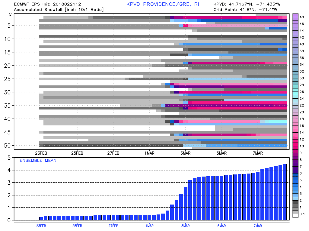
As you can see below, there are several EPS members that bring a moderate or major snow event to the Providence area in early March. It’s only about 20% of the members, but it shows the potential for this pattern to bring wintry weather if the storm in the Atlantic Ocean is close enough (but not too close) to the coast.