The workweek will begin with warm and humid weather in Southern New England. Expect highs in the 80s coast to low 90s inland on Monday. The humidity will be high, with dew points near 70°. There is a slight chance of inland showers/storms Monday afternoon. It will most likely stay dry.
Showers and t-storms are likely late Tuesday as a strong cold front sweeps away the muggy weather in the midweek. Expect tropical humidity on Tuesday ahead of the front. If there’s enough sunshine during the day, some of the t-storms could be strong to severe – especially inland. It’s the best chance of widespread rain in the next 6 days through the end of the workweek. Wednesday through Friday look nice with seasonable temps and lower humidity.
A slow-moving storm system brings a weather pattern change late next week. Showers and t-storms are possible next weekend as the large upper-level low pressure system rolls to the east. Tropical humidity returns with a deep southerly flow at the surface and aloft. The slow-moving system may stall and weaken over a few days between July 22-24. If that happens to our west, you can expect scattered showers/storms in that time frame. A very dry month of July could take a wet turn.

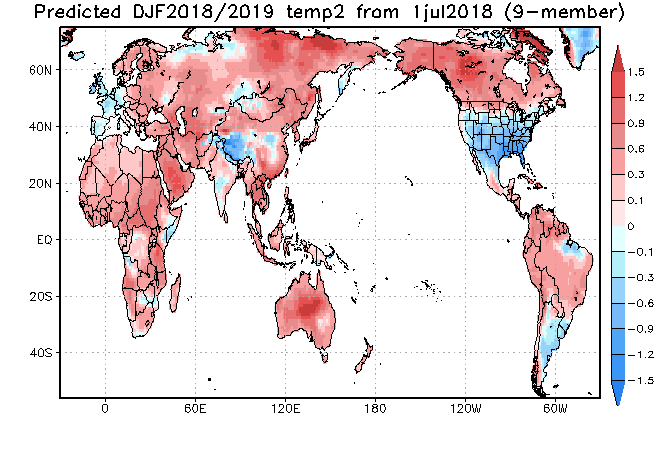
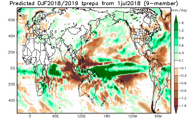
For what it’s worth, the JAMSTEC (Japanese) model is predicting a cold winter (Dec-Feb) in the Eastern United States for the third straight month. As you can see below, it also projects above normal precipitation in those months. If that plays out, it will be a nice winter for snow-lovers. I will be keep an eye on these forecasts over the next few months.