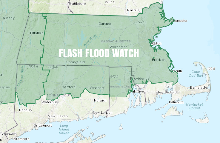
A Flash Flood Watch is in effect for the inland counties in Connecticut, Rhode Island and Southeastern Massachusetts. The remnants of Florence will pass by on Tuesday with heavy showers and thunderstorms possible, and some areas could receive 2-4″ of rain in just a few hours. That would lead to street and stream flooding in some towns.
The workweek begins with an unseasonably warm and humid day. Expect highs in the upper 70s to mid 80s, with dew points in the mid to upper 60s. There should be in and out sunshine through the day. It stays mild and very humid overnight, with showers arriving after midnight and continuing through the day on Tuesday. Lows will not be far from 70 degrees Monday night. A record warm low temperature is possible on Tuesday.
Most of CT, RI, and SE MA is under the gun for 0.5-2.0″ rain on Tuesday. It looks like the heavier rain will set up over the Berkshires through central and northern Massachusetts. The best chance of heavy downpours is midday into the afternoon. It may not be raining the whole day, but the rain that happens may be heavy enough to cancel/postpone outdoor events/sports in the afternoon/evening. Expect a tropical feel with temps in the 70s on Tuesday.
Fair and less humid weather arrives Wednesday into Thursday. Expect highs in the 70s and lows in the upper 50s to low 60s. An approaching front swings the wind back around to the southwest on Friday. It should be warm and muggier, with highs in the mid 70s to near 80. The front moves through Friday night with passing showers. Saturday looks pleasant and dry with lower humidity. Another storm system arrives Sunday afternoon or night with more showers for early next week. After the Sunday PM – Monday rain threat, most of next week looks dry and most likely cooler with an early fall feel.
The tropics are expected to be relatively quiet in the next 7-14 days.
