A wild weather day in Southern New England is ending with passing showers and t-storms this evening. Afternoon showers/storms brought everything from likely tornadoes to Rhode Island (North Providence / Lincoln) and Eastern Massachusetts (Norton) to waterspouts off the RI coast and near Cape Cod to some great rainbows – see below.
https://www.instagram.com/p/BpSRMHhAvs9/?taken-by=fcampagna
The dynamic storm’s center will move east of New England by early Wednesday, with a disturbance swinging through in the afternoon bringing scattered showers and t-storms to Southern New England. Severe weather is unlikely, and it will be blustery and cool with temps around 50.
Thursday and Friday look dry and relatively cold for late October. Highs will be in the 40s on Thursday and near 50 on Friday. Lows may be below freezing Friday morning. Expect some sun on Thursday and early Friday, with clouds streaming in late Friday.
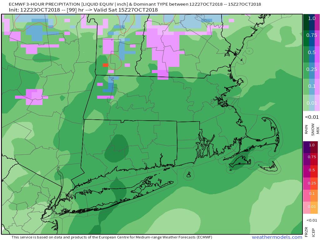
We are looking at a wet start to the weekend. Rain will most likely arrive by dawn on Saturday, and it will become steady in the early to mid morning. The steadiest rain may move out by mid to late afternoon, but showers will linger. Expect gusty winds, with potential for 40+ mph near the coast. Temperatures will be in the low to mid 40s early in the day, and rise to the upper 40s to low 50s by late in the day. There may be enough cold air at the onset for a brief period of snow/sleet in the high terrain of CT and RI, but I do not expect it to last long or be cold enough for any wintry travel impact. There may, however, be an inch of rain, and that combined with leaves taken down by the wind/rain could lead to some slippery spots.
Rain is likely on Saturday
Saturday night and Sunday do not look as wet. There’s a chance Sunday could be mainly dry with temps in the 50s before another round of rain arrives Sunday night into Monday. I’ll keep you posted!
