A gray and seasonably cool Columbus Day gives way to warmer weather in the midweek. The temperature will likely shoot into the 70s Tuesday through Thursday. With enough sunshine, a day or two could reach the 80s inland. Given the longer nights of early fall and high humidity, there will be some mist, fog, and clouds to burn off each morning. Lows in the 60s are likely through the midweek.
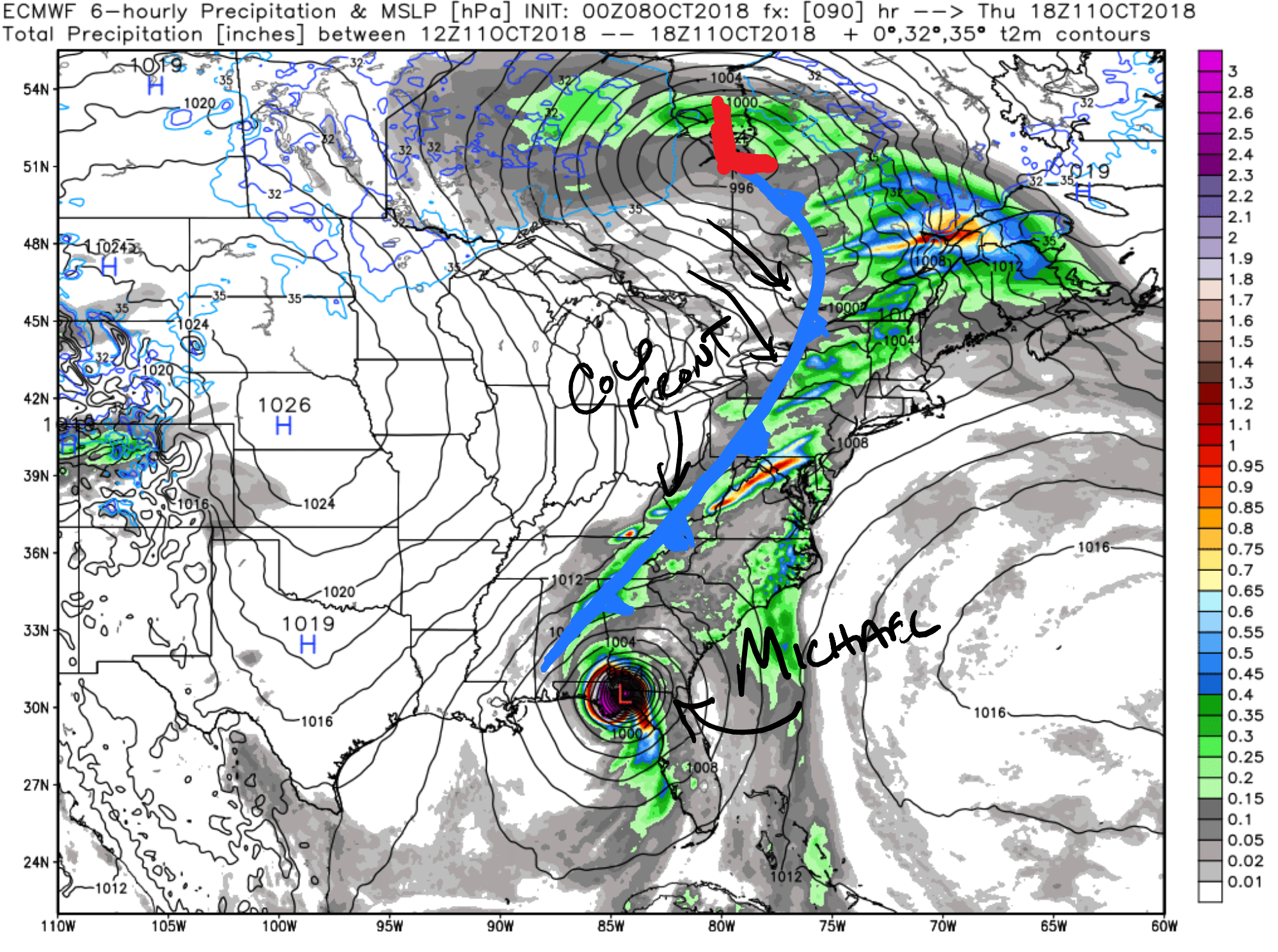
The weather setup showing the cold front scooping up Michael and steering it to the northeast after it makes landfall in Florida on Thursday
A cold front brings showers followed by cooler weather Thursday into Friday. It will also scoop up Michael and send it out to sea south of New England. The latest information from last night suggests that Michael is likely to move through the Carolinas and take a track far enough south that there is not much of a wind/rain impact in New England. Given that the storm is still strengthening in the Gulf of Mexico, and it’s exact path into the Gulf Coast is somewhat uncertain, I am not ready to slam the door on a potentially wetter/windier impact in eastern New England. At this time, though, the most likely scenario is a near miss without much of an impact.
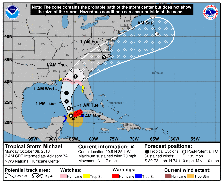
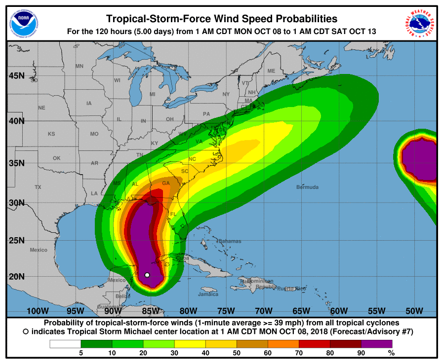
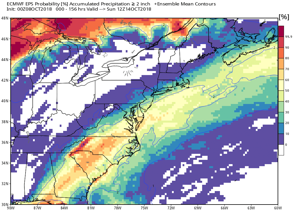
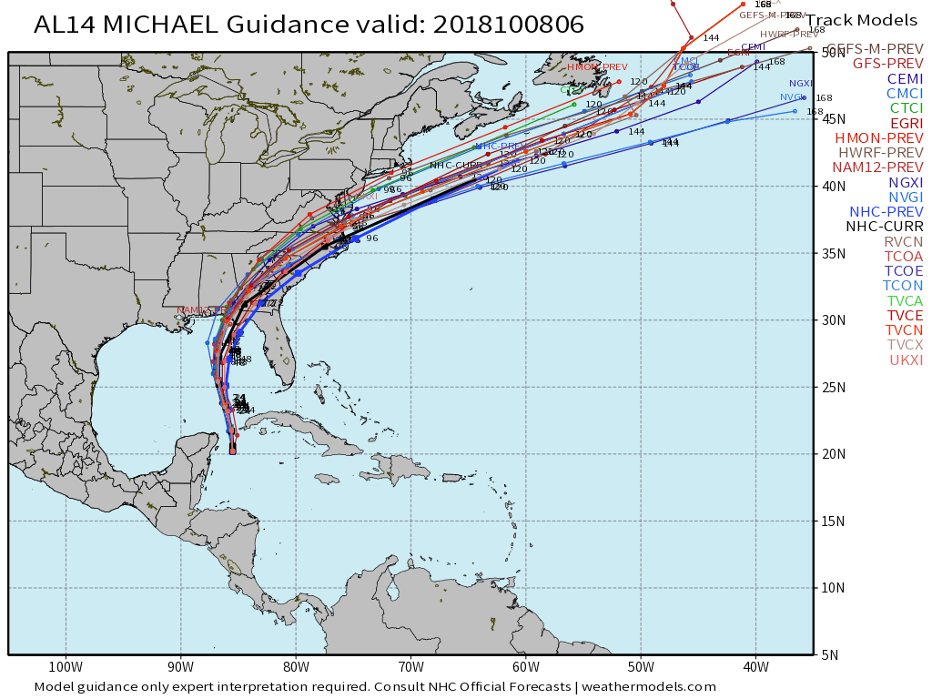
The National Hurricane Center forecast has Michael making landfall late Wednesday evening on the Florida Panhandle. I think it will be a bit later than that – probably Thursday morning.Notice the wind field for Michael – there is a less than 10% chance of tropical storm force winds in Southern New England. Typically, when tropical systems are being pushed out to sea by the jet stream, they are not carrying much wind on the northwest side of the stormThe European model suite keeps the heavy rain in the Carolinas to the Delmarva and then offshore. There is a better than 50/50 chance of at least 2″ of rain in south of Long Island and near Nantucket, so a slight shift north in the track would bring heavy rain to coastal New England. That’s not the most likely scenario at this time.There are several hurricane models that track Michael northwest of the official NHC forecast (black line). I expect the computer model spread to narrow today or tomorrow.