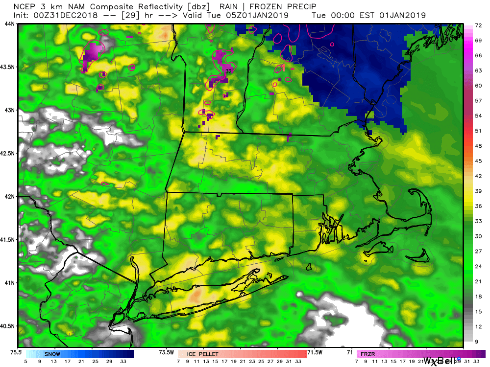
The winter season started early with a mid-November snow storm in Southern New England. Since then, however, there has not been much snow. The weather pattern will likely not change much this week with the storm arriving on New Year’s Eve bringing much more rain than snow. It seems fitting that one of the wettest years on record in Southern New England ends with a rain storm on New Year’s Eve.
Rain arrives by sunset in New York City and overspreads Connecticut, Rhode Island and Massachusetts during the evening. The best chance of a brief burst of snow before rain is in the NW and NE Connecticut hills. A minor accumulation is possible there, but it will be rain for everyone else in CT, RI and SE MA. The rain may be heavy at times in the evening and overnight, so use caution if you’re driving on New Year’s Eve.
Another inch or more of rain is possible Monday night
Rain ends by dawn on Tuesday, with temperatures rising through the 40s into the 50s overnight. It will be windy and warm on New Year’s Day. Expect the temperature to be in the 50s in the morning then fall through the 40s in the afternoon. Dry and chilly weather is ahead for Wednesday. Look for highs in the 30s.
The second storm system of the week arrives either Thursday or Friday. It looks like more rain than snow again, but a wintry element at the start cannot be ruled out. There’s a lot of uncertainty about the timing and intensity of the storm. For now, expect a chance of snow/rain on Thursday, and rain likely on Friday. The storm system should move away early next weekend, and it looks relatively mild Saturday and Sunday.
So, when will the pattern change to something more like winter? The predominant storm track is slowly shifting east (colder) and it looks like there’s a better chance for wintry precipitation in the second week of the year.
