We brought sixty back to part of Southern New England on Monday. Some towns, mainly away from the water, reached a wonderful 60 degrees Monday afternoon with mostly sunny skies. A breeze kept it cooler near the coast. Expect patchy fog and some mist overnight. I do not expect nearly as much frost or black ice on Tuesday morning as the temps stay above freezing for most Monday night. Tuesday promises to be very mild if the low clouds and fog early in the day burn off to a decent dose of sunshine. I expect highs in the upper 40s to mid 50s – very warm for early February.
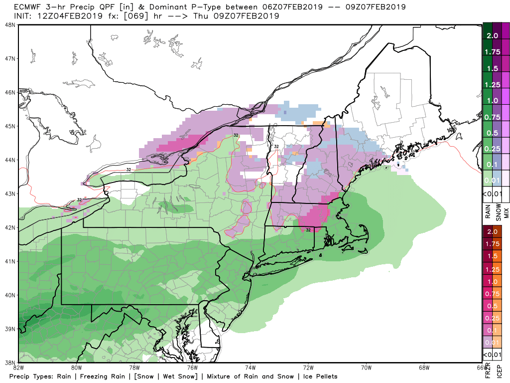
It turns a bit cooler and stays dry through the day on Wednesday. Look for highs in the low 40s. The weather setup for Wednesday night is complicated. It looks like a mainly or all rain event for most of CT, RI, and SE MA, but a period of freezing rain cannot be ruled out as the there will be a shallow layer of chilly air at the start of the event. Right now, I think the models are running a little cold, and I’m leaning towards mainly rain, but it’s something to keep an eye on. The best chance of freezing rain is in NE CT and NW RI between 9 pm Wednesday and 5 am. Thursday. I will have more on this potential tomorrow.
Plain rain showers are likely on Thursday as the temperature gets into the mid-upper 30s and possibly low 40s near the coast. Milder air arrives Friday, but likely comes with another surge of rain showers. Expect highs in the 40s to near 50. The temperature falls quickly Friday night, and the weekend looks chilly and dry. Highs may not get out of the 20s on Saturday, and Sunday will be in the 30s.
The early outlook for next week is for seasonable temperatures and the possibility of some (believe it or not) snow. The computer model ensembles are all showing a higher chance of snow between February 11-20. While it’s unlikely that this season will get to normal or above normal snow totals, I think it’s too soon to write off a couple of at least moderate snow events in the next 4-5 weeks.
