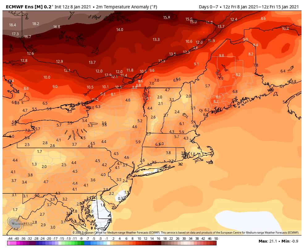
Winter 2020-21 got off to an active start in December, but the pattern has shifted to dry and relatively mild weather in early January. The next two weeks are the climatologically coldest part of the year in Southern New England. However, the weather will likely be warmer than normal in the Northeast by a few degrees.


Expect mainly dry weather through January 15. It will get mild later in the week with temps climbing into the 40s ahead of a cold front that may bring some rain showers late in the workweek. At this point, it does not look like much precipitation.

There’s not much for snow-lovers to get excited about into the MLK Day weekend. There was a lot of buzz on social media around the New Year about an active wintry weather pattern developing in the Eastern United States, but that has not come close to materializing.
Remember, there is still a lot of winter left. Most of the time in the past 5-10 years, the second half of the winter (late-January to mid-March) has produced more snow than the first half. The winter of 2014-15 went from one of the least snowy to one of the snowiest on record in Southern New England. I’m not saying that will happen this year, but it’s too soon to completely write off this winter in Southern New England.

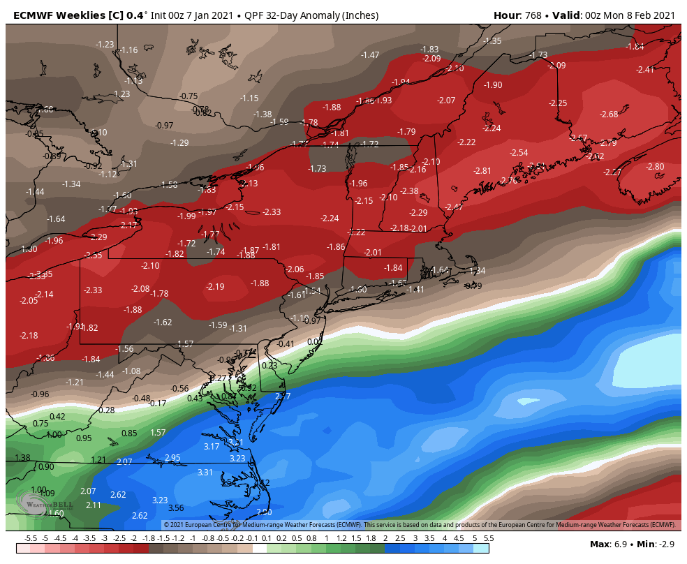
Long-range forecasts, which are not always accurate, predict relatively dry weather in the next month in New England. Notice how the precipitation is above normal south of New England, indicating that the storm track may stay active in the Southeastern United States and not move up the coast to New England.