


11 am update
The temperature climbed into the upper 70s by late Monday morning, and it will reach the low to mid 80s inland during the afternoon. Near the coast, highs will be near 80 before falling back into the 70s as the wind turns onshore. A front approaching from the northwest may trigger a line of showers and thunderstorms that develops in New York and Northern New England this afternoon before sliding south into Southern New England early this evening.
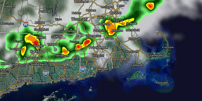
[/raw]Showers and t-storms are possible in Southeastern New England primarily between 5pm-11pm Monday evening. Some of the thunderstorms could be strong to severe, especially inland. The main threats from the storms are strong winds, hail, heavy downpours, and lightning. The shower/storm threat ends by midnight. The temperature will fall into the low 60s overnight.
Another round of showers is likely on Tuesday, and we are eyeing the potential for more rain late Tuesday night into Wednesday. A storm developing over the Mid-Atlantic may come close enough to bring rain to coastal Southern New England. There is also still a decent chance that the storm stays far enough away that high pressure and clearing sky are able to move in from the west.