From Fred to Henri to Ida, I have been babysitting hurricanes for the past three weekends. I’m looking forward to a break in the action near the United States in the coming week or two. The peak of hurricane season is in early September, but long-range models are not showing much action threatening the U.S. in the next 10-15 days.
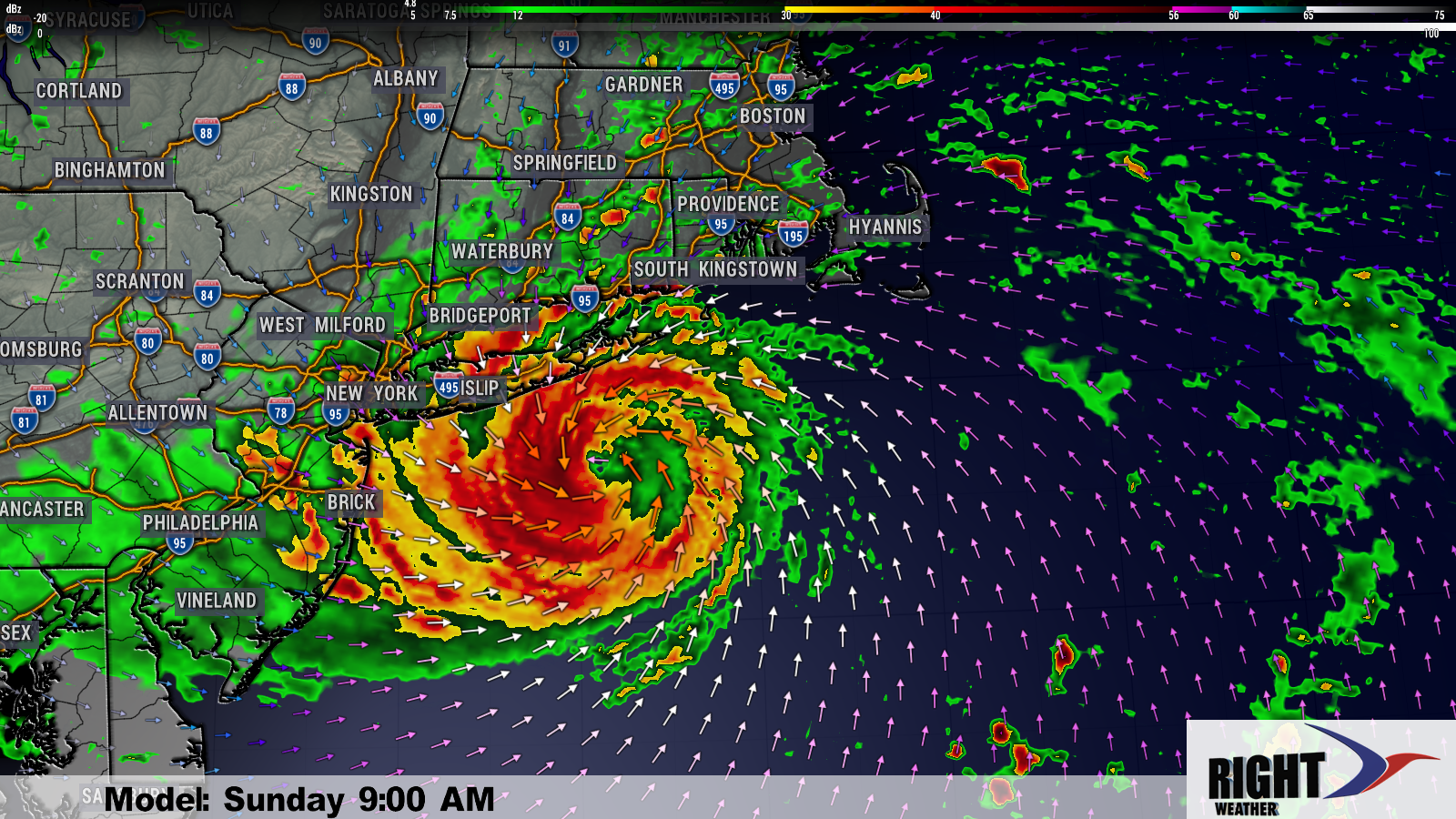
In the near-term, what’s left of Ida will bring soaking rain to Southern New England from late Wednesday through midday Thursday. Flash flooding is possible with 3-6″ of rain possible in Connecticut, Rhode Island and Southeastern Massachusetts. It will be breezy, but not extremely windy for most of Southern New England. The exception could be near the coast where it may gust over 40 mph.

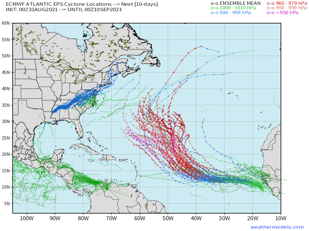
After Ida departs, the weather looks pretty quiet and not extremely warm heading into Labor Day weekend. The image below shows the tropical activity expected in the next two weeks. This is a map featuring 50 different ensemble models, and that’s why there are so many lines on the map. A hurricane will likely form in the central Atlantic Ocean, but should not come close to the United States. The weather looks relatively quiet in the Gulf of Mexico as Louisiana recovers from Ida.
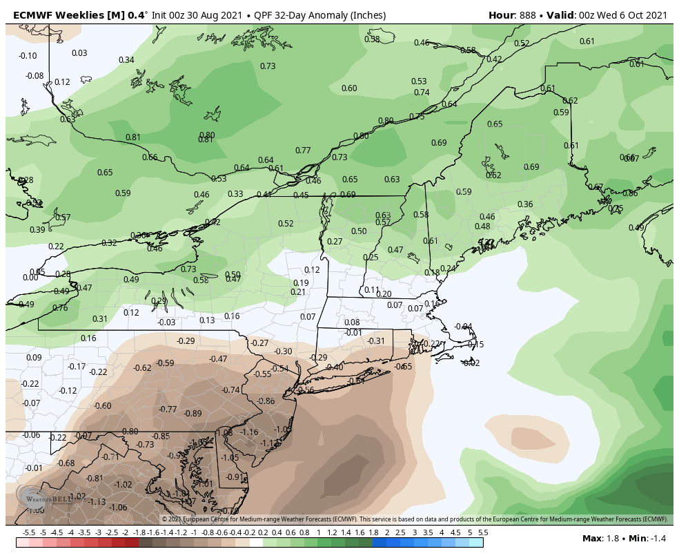
This summer featured above normal rain in Southern New England, and the fall gets off to a quick start with Ida’s remnants possibly bringing all of the normal September rainfall. After that, however, it does not look like the pattern will be quite as wet through September into early October. This can be skewed by a tropical system (see Ida and Henri), but the overall pattern is not very wet.
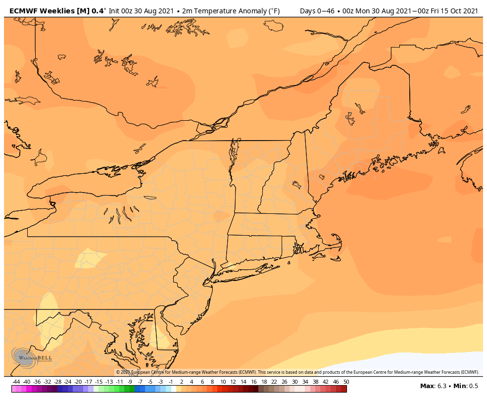
The overall weather pattern for the next 6 weeks also looks warmer than normal in New England. Both the long-range American and European models are predicting near to above normal temps. The American model is not quite as bullish with temps about 1° above normal. The Euro model predicts about 2-3° above normal.