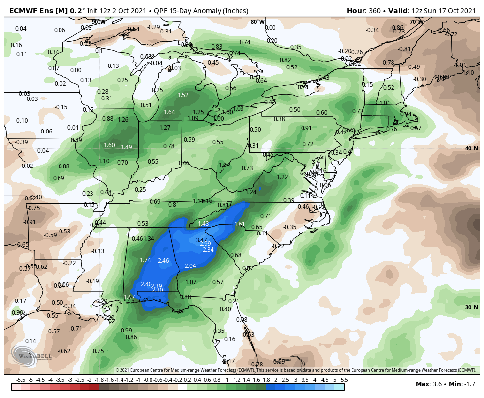
The first full week of October will likely begin and end with showers in Southern New England. A system coming through on Sunday evening will linger into the early part of the workweek. Showers are possible Monday through Monday night into midday Tuesday. It looks like a pretty good soaking over the approximately two-day stretch. Most of Southern New England will get more than an inch of rain, and some areas may get 2″+.


Dry weather is likely in the mid to late workweek. Look for high pressure to nose in from Eastern Canada and keep a slow-moving storm system to the west into the weekend. Eventually, that storm system will drift east, and showers will likely return for part of the Columbus Day weekend. The best chance of rain over the holiday weekend is Sunday/Monday based on how the computer models are handling the situation.

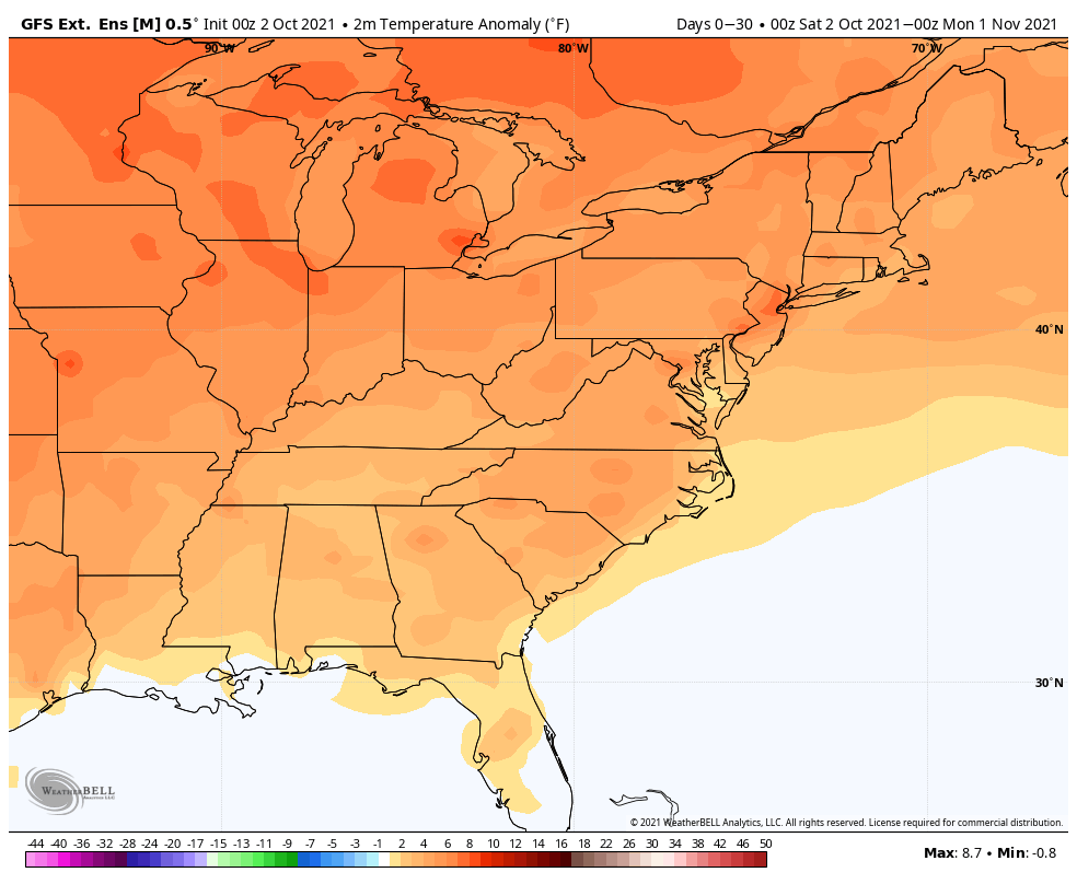
The long-term outlook for mid-October is for relatively warm weather in the middle of the month. Overall, October is shaping up to be warmer than normal with near or above normal precipitation. If the storm system early this week delivers on it’s promise of 1-2″+ rain, then there’s a good chance October as a whole will be wetter than normal. With the relatively warm weather expected, the odds of early-season snow are pretty low.
The normal high temperature is falling into the 60s at the start of the month, and it will be in the 50s by Halloween. The normal low temperature falls all the way to near 40 by the end of the month.
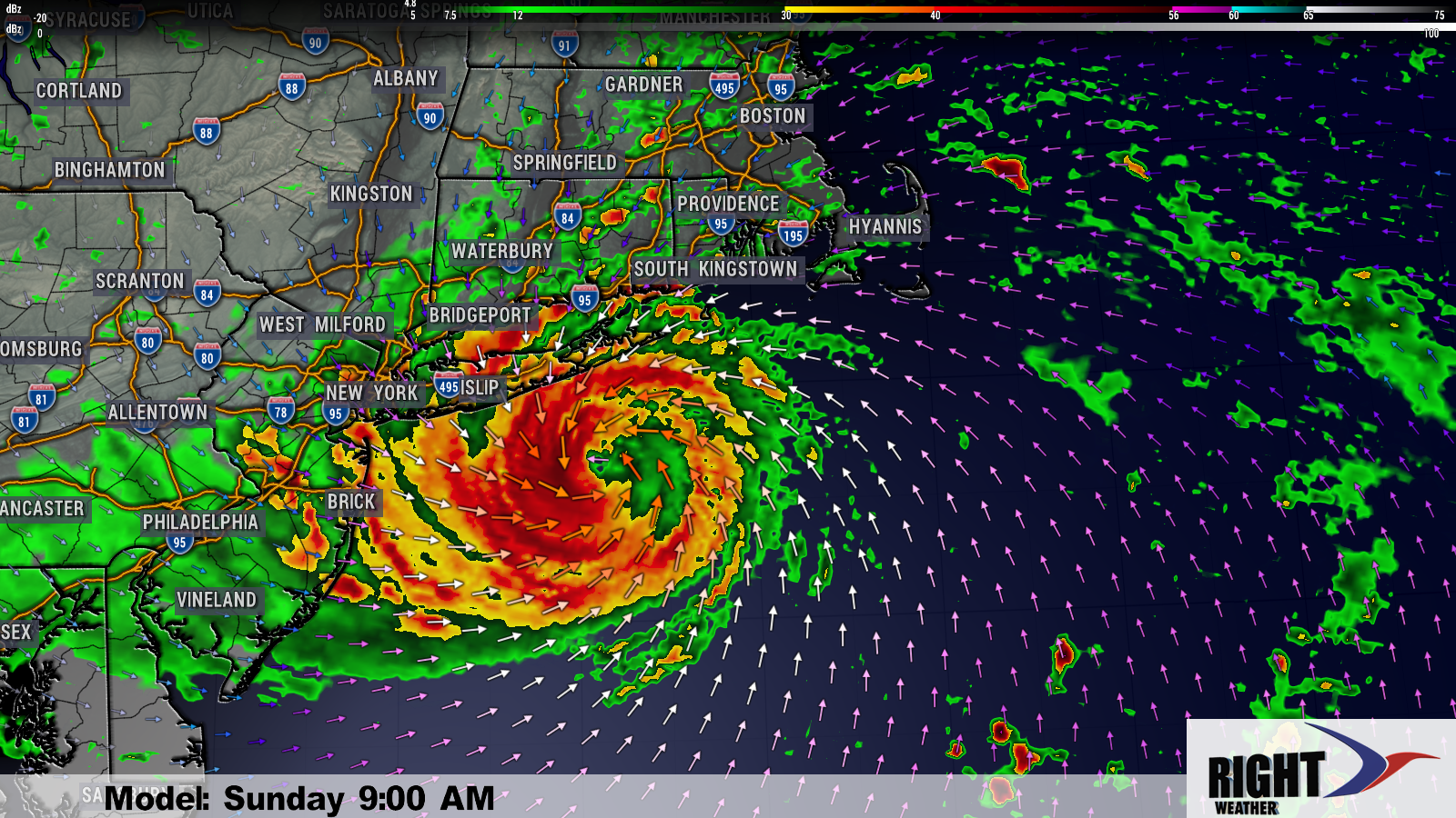
The tropics typically quiet down as the month progresses. An intact hurricane has never reached the New England coast after October in recorded history. That’s not to say there can’t be some very impressive storms (The Perfect Storm and Sandy) but the water off the coast cools enough that the storms lose their tropical characteristics. The bottom-line is we’re in another active hurricane season and some stormy action near the Eastern Seaboard is certainly not out of the question as we go through mid-Autumn. There’s a very good chance that the last name on the list, Wanda, will be used this year. Rather than use the Greek alphabet, there is a supplemental list of names starting with Adria, Braylen and Caridad.