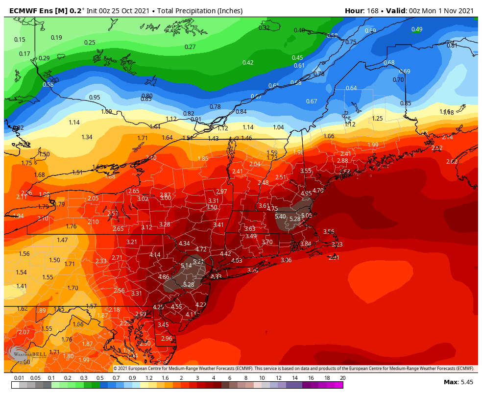
A very intense storm will form just off the Southern New England coast Monday night into Tuesday. The storm will bring heavy rain, damaging wind and rough surf to Southern New England in the middle of the week. Expect very wet weather Monday night into Wednesday morning, with more than 3 inches of rain possible in the hardest hit areas. Most of Southern New England should get at least an inch of rain from the storm. The rain will come in bands, and there may be some breaks between heavier downpours.

The wind will be a big factor as it picks up during the day on Tuesday, peaking from early Tuesday evening into Wednesday morning. The north-northeast wind will likely gust to 50 mph in most of Rhode Island. It may reach near 60 mph at the RI coast, and could be over 60 mph around Buzzards Bay and Cape Cod. Most trees still have foliage, and power outages are likely in areas where the wind gusts over 50 mph.

The storm will drift away during the day on Wednesday. Expect rain in the morning, and it may stay damp in the afternoon. It looks drier Thursday and Friday before another rain storm arrives for the first half of the weekend.