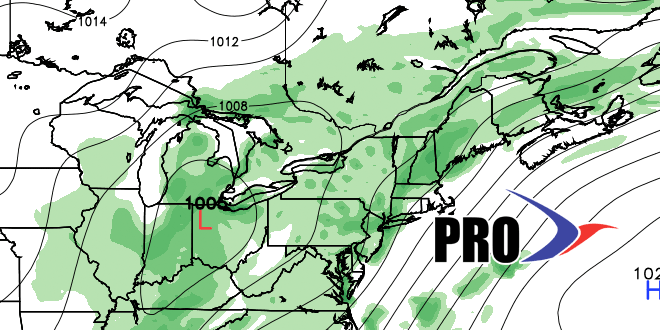
The prospects of a very unsettled late-June and early-July continue for the entire Eastern United States. A super slow-moving upper-level low will be stuck over the Great Lakes or Ohio Valley from late this week through all of next week. The upshot is a showery and humid pattern to the east of the upper-air system. At this point, it’s hard to know exactly where the dynamics will be most favorable for heavy rain. In a worst-case scenario it will be a very soggy first week of July in Southern New England, with several inches possible. In a best-case scenario, showers and come and go, but the heavier rain sets up somewhere else – most likely to the west of Southern New England.
90° heat is most likely out of the picture for at least a couple of weeks after this hot stretch ends in the midweek. It will, however, be quite humid during the unsettled pattern in late-June and early-July. That means low temperatures will be running well above normal in the mid 60s to low 70s.


