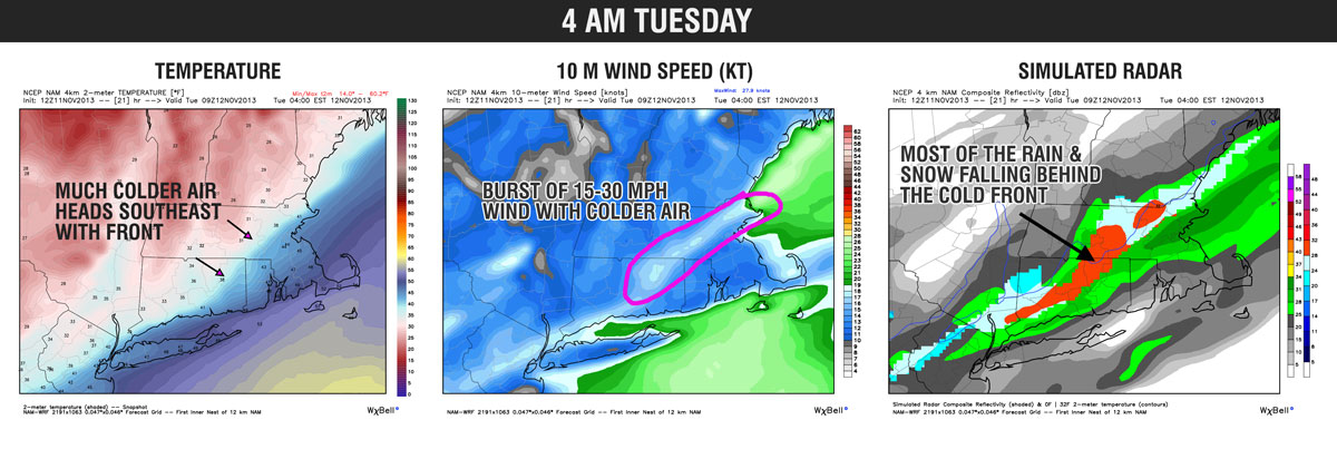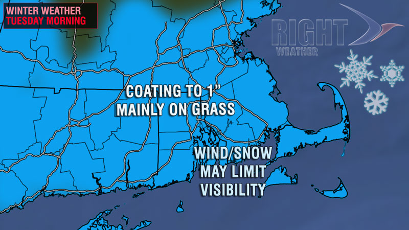
The first flakes of the season in Southeastern New England may coincide with the Tuesday morning commute. If the timing is just right, cold air will arrive at the same time as showers move through Southern New England just behind a cold front. Rain and mixed precipitation showers will likely change to snow showers and squalls as the cold air rushes in behind the front. The temperature will drop from the 40s after midnight to the low 30s around dawn when the snow showers arrive.

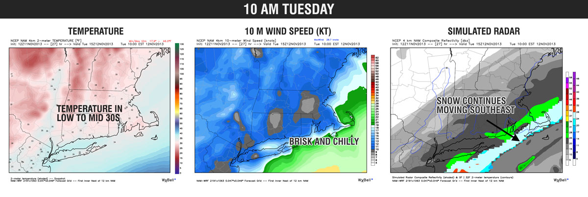
The morning commute could be affected by the wind and snow showers. Significant accumulations are not expected, but the combination of snow, wind, and falling temps could lead to slick travel. The snow showers should move out of the picture by midday, and it will stay cold and blustery through the afternoon. The temperature will likely hover into the mid to upper 30s Tuesday afternoon, but it will feel colder because of the 10-20 mph northwest breeze.
Check the graphics below for a timeline on the burst of rain and snow expected in Southern New England. Click images to enlarge. Model data from weatherbell.com.