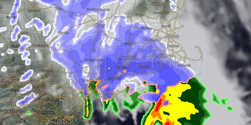
The break between storms in Southern New England will not be a long one. A fast-moving disturbance will bring a 3-5 hour burst of snow and mixed snow/rain during the afternoon on Tuesday. Snow will develop late in the morning, and it may be heavy at times in the afternoon. The wind will be out of the east-southeast, and it should bring in enough mild air to change the snow to rain at the immediate coast during the afternoon. The best chance of a mainly rain event is on Cape Cod and the islands. Elsewhere, there should be at least a coating of snow. Several inches may accumulate inland. A Winter Weather Advisory and Winter Storm Warning is in effect for part of Southern New England.

Snow will continue through the afternoon before ending early in the evening. The afternoon commute could be slowed by snow, especially north of Providence to Worcester and Boston. Highs will be in the low to mid 30s on Tuesday.
Skies will clear Tuesday night, and the temperature will fall into the mid 20s by dawn Wednesday. Some icy spots are possible on untreated roads. Clouds will increase on Wednesday ahead of yet another disturbance that will threaten with rain showers during the afternoon. It will be milder, with highs in the low 40s.

Thursday looks like the nicest day of the workweek. Highs will be in the low to mid 40s under partly cloudy skies. Friday will be milder, but rain is a threat. The temperature may soar into the 50s with a gusty southwesterly wind with a warm front / cold front combination that will bring occasional showers. Most of the weekend looks dry, with Saturday the milder of the two days.


