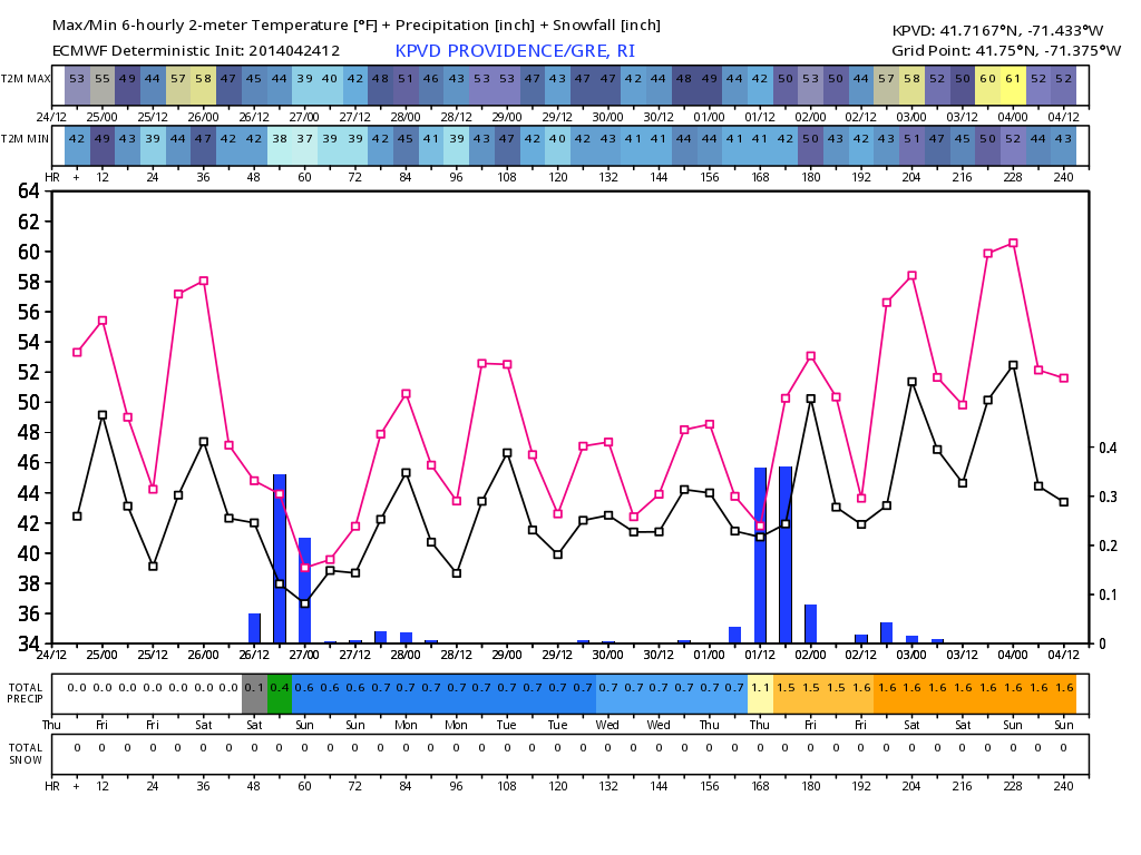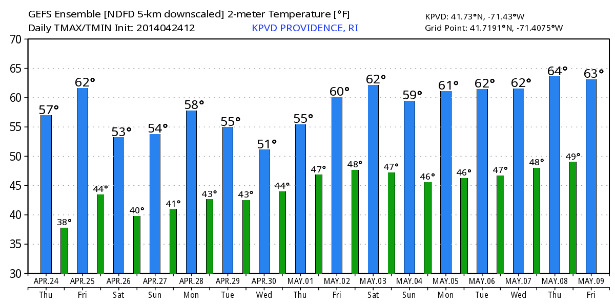
The blocky, slow-moving weather pattern we have advertised for the past couple of weeks will really take shape next week. Initially, the weather will be quiet and cool in Southeastern New England early in the week, but it will transition to cool and unsettled for the mid to late workweek. It should reach 60° on Friday, and that may be the only time it gets that warm for the rest of the month. The wind will be out of the northeast on Monday and Tuesday, and highs will likely stay in the 50s.
As a slow-moving storm approaches on Wednesday, the high temperature will continue running well below the normal high in the mid 60s. If the rain is steady Wednesday, Thursday, and/or Friday, then it’s possible the temperature will hover in the low 40s all day. Yuck!
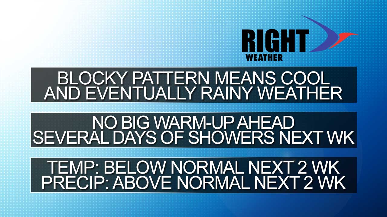
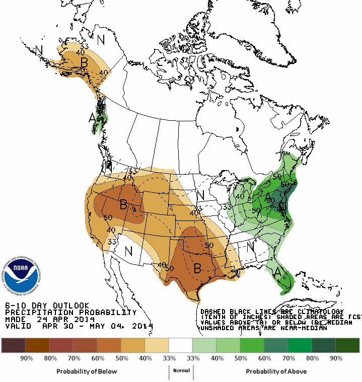
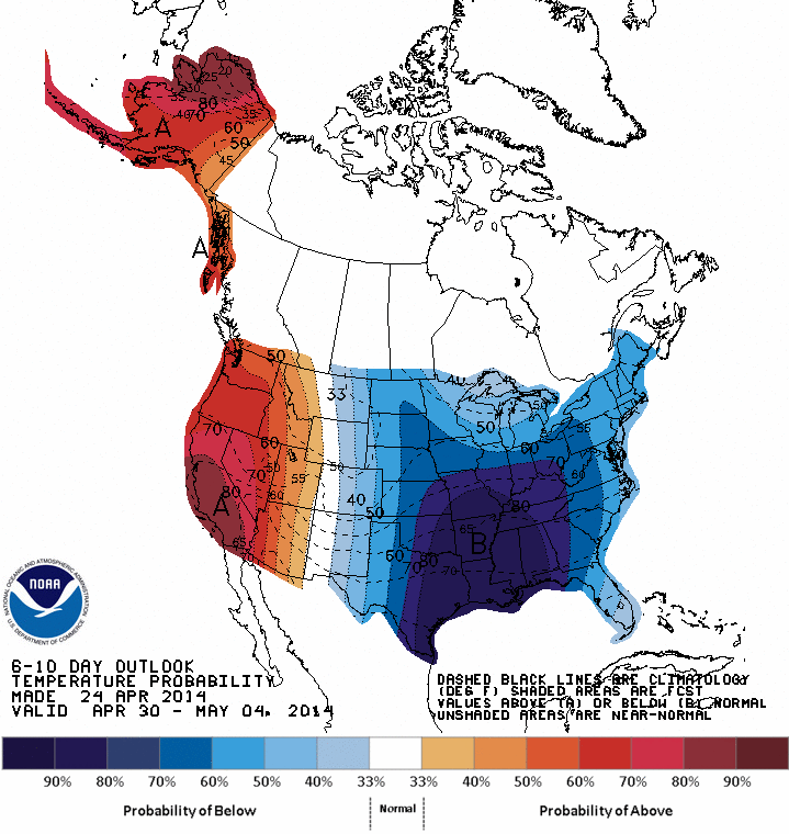
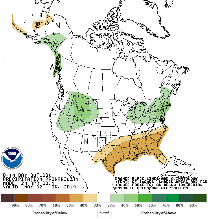
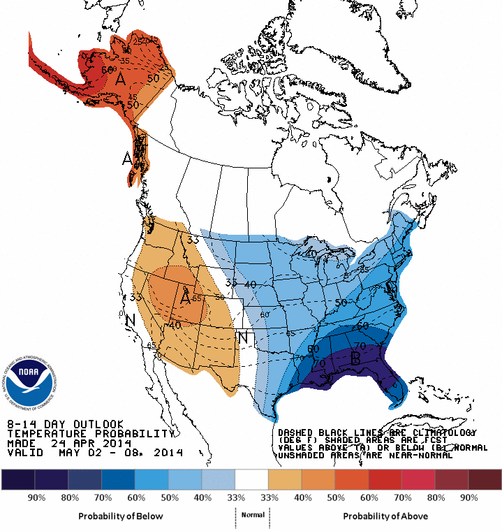
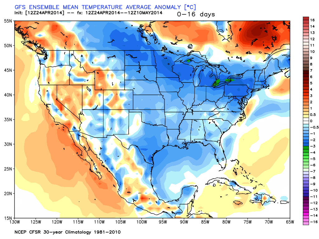
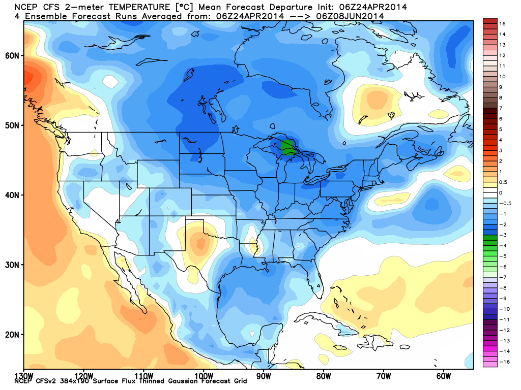
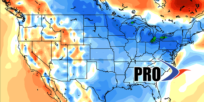
The plodding storm will be cut off from the jet stream, and it may move out of the picture by the first weekend of May. If so, the temperature will most likely bounce back into the 60s – at least for a few days. The overall outlook for early May is for a persistent sluggish weather pattern that will feature mostly sub-par weather in the Northeast. That big warm-up with an extended stretch of great weather is not likely in the next two weeks. Check out the images below for more analysis.