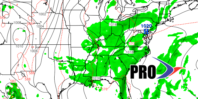
Long-Range Forecast – July 15

The threat of locally heavy rain continues through late Wednesday as a front slowly eases through New England. The best chance of torrential downpours in RI and SE MA is from Tuesday night through mid-afternoon Wednesday. A Flash Flood Watch is in effect through that time.
After the storm system moves offshore, there should be a decent stretch Thursday into, and possibly through, the weekend. The latest information suggests that most of the showers along the Eastern Seaboard Saturday and Sunday will stay out of RI and SE MA. It may not be the sunniest weekend of the summer, but, at this point, it does not look bad with highs in the upper 70s to low 80s, and lows in the 60s under partly cloudy skies.
The same general weather pattern will hold into the middle of next week. We’ll be watching the progression, or lack thereof, of a disturbance in the Eastern United States. This time of the year, a ridge may be able to hold on and keep Southern New England in typical mid-summer weather with some humidity. By late in the week, the shower threat increases, and it’s unlikely to stay completely dry through next weekend.
While the occasional very warm to hot day is possible, we are not expecting any extended 90°+ stretches through the next two weeks. To date, the highest temperature of the year in Providence is 91, and there have only been three 90° days – a far cry from last year.
We do not see the tropics becoming active in the next two weeks.


