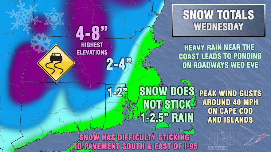
A poorly timed storm will bring accumulating snow to part of Southern New England on the Wednesday before Thanksgiving. The snow accumulation forecast is particularly difficult with this storm because of a lack of cold air at the surface. Snow will be falling for a good chunk of Southeastern New England during the day on Wednesday, but temperatures a couple of degrees above freezing could prevent it from sticking to the pavement.

Precipitation will break out early in the day, and may become moderate to heavy in the afternoon. The best chance of pasty snow accumulation is inland – north and west of the I-95 corridor. As the storm center nears late in the day, there may be a change to sleet and/or rain in Providence and Boston. Right now, we are favoring sleet or rain in these areas in the evening, but it is a very close call. If snow hangs on past sunset, then there will likely be accumulations in the I-95 corridor. A 25 mile shift east in the accumulation map contours brings plowable snow to Providence and Boston.
The precipitation will end around midnight, and the temperature will slip to at or below freezing in most inland locations by late Wednesday night. Some icy travel is possible. From the coast to I-95, the temperature will be in the low to mid 30s, and there is a lower chance of slick roads, but some icy spots cannot be ruled out.


