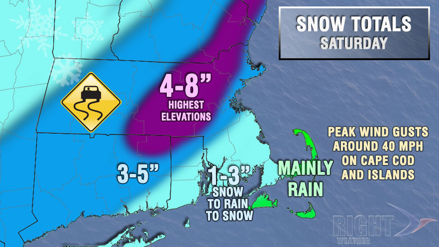
A fast-moving and potent storm system will pass by New England on Saturday. The storm will begin before dawn in Rhode Island and Southeastern Massachusetts, and it will end in the mid to late evening. There is uncertainty about the precipitation type at the height of the storm from just northwest of I-95 through Worcester County. It’s likely that there will be a change to rain then back to snow from the coast to I-95. Accumulations will range from an inch or less near the coast to as much as 8-10″ in the hardest hit areas inland.

Snow will likely develop between 4-6 am Saturday in Rhode Island and Southeastern Massachusetts. Snow will change to rain from south to north during the morning. An inch or two of snow is possible before the change to rain in most of RI and SE MA. Snow may hang on a bit longer in the hills of NW RI. Rain may be heavy at times during the late morning and through most of the afternoon. The temperature will only be in the mid 30s, and snow that fell earlier in the day may not be completely washed away.
As the storm passes early Saturday evening, there is likely to be a change back to snow from northwest to southeast. It does not happen often, but accumulating snow is expected on the back side of this storm. There will likely be up to 2″ of snow from the coast to I-95 Saturday evening with the storm ending before midnight. Temperatures will fall into the 20s Saturday night, and some icy roads are possible.
Peak winds will be over 40 mph on Cape Cod and the Islands, with 30-40 mph gusts possible near the RI coast and Buzzards Bay.


