January through March will be the coldest on record in Providence by quite a bit, possibly as much as 1.5° over some years from the early-1900s. That is incredibly impressive considering the amount of urbanization that has happened since then. The overnight low temperatures are typically not as cold now as they used to be. It sure helped to have a deep snowpack for the past couple of months.
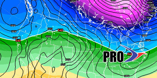
Looking ahead to early April, we’re getting into “freak” territory for any plowable snowstorms. There have only been eight Aprils in the last 110 years with more than 5″ of snow in the Providence area. The average for the month is 1.3″. In most years, there is a trace or less of snow for the entire month. Our first shot at snow comes just after midnight on April Fools’ Day. It looks like a storm will be just far enough south to not bring a minor snow accumulation to Southern New England. After that storm passes by, there will be a brief warm-up late in the workweek. Some rain is likely Friday into Saturday. Easter Sunday looks dry and cool.
The overall pattern should be pretty active for, at least, the first couple of weeks of April. While snow is not likely, it’s not out of the question, either. The ground is very soft in Southeastern New England, and an above-normal month of rain could wreak havoc with school sports, baseball, lacrosse, and soccer leagues, and anyone wanting to get out on the golf course.
It does not look like there will be an extended warm-up anytime soon. There is a good chance that April is the fourth straight colder than normal month, but it does not look as cold (relative to normal) as the past three months.


