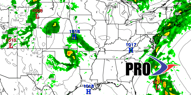
It feels like mid-summer in late May in Southeastern New England. The warmth comes with more humidity for the start of the Memorial Day weekend. Highs may reach 90° inland on Saturday and Sunday. An approaching cold front will scoop up some tropical moisture from the storm that becomes Bonnie near the Southeastern United States coast. Showers and t-storms are likely on Monday after seeing just scattered afternoon t-storms Saturday/Sunday. Highs will be in the 70s on Monday.
We will likely get back to warm sunshine on Tuesday, with highs in the 80s. A developing easterly breeze in the mid to late workweek will bring pleasant conditions Wednesday-Friday. A cold front approaching from the west may deliver showers late Friday into next weekend. Odds are the rain will only be an issue for one of the two weekend days. After a dry start to the following week, rain threatens again by midweek as another system arrives from the Great Lakes.


