Southeastern New England is getting a break from 90° heat and high humidity for a couple of days in the middle of this week. It looks like it will get hot and humid again by this weekend, and hot weather may last into next week. The weather pattern will be somewhat unsettled along the East Coast next week. After a hot, humid start to the week, it will likely stay humid, but the heat may ease as showers and storms threaten in the midweek.
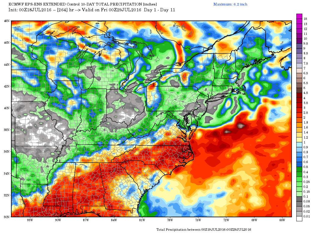
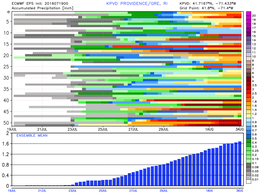
A boundary along the Appalachian Mountains will be the focal point for showers and storms in the middle to end of next workweek. It looks like that boundary may drift east late in the week increasing the chance of rain in Southeastern New England. It’s definitely too early to say that it will be a wet end to the month, but the pattern favors a higher chance of rain than we’ve seen for most of this summer. Lately, Southeastern New England has seen the usual scattered thunderstorms that produce heavy, but localized, rain. If this front stalls near the Eastern Seaboard, there is a better chance for widespread rain.
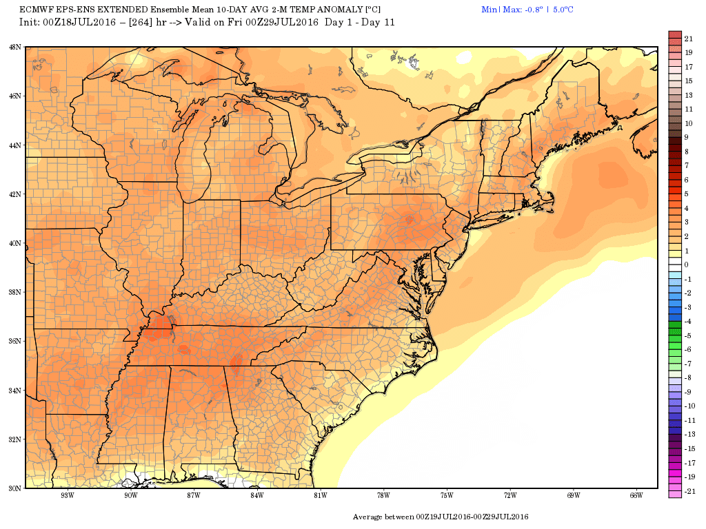
There is a lower chance of 90°+ heat late in the month with the boundary nearby. Even if it’s too our west, there will be some clouds around, and the, although very humid, that setup does not favor very hot weather in Southeastern New England. It would, however, be mild and muggy at night. If the boundary is a little farther west than currently projected, then the wind could back to the southwest, and that would lead to hot/humid weather.
Overall, I would not expect any lengthy cool and/or pleasant stretches in the next couple of weeks. It’s mid-summer, and it will feel like it most of the time in Southeastern New England.