This meteorological summer, among the warmest on record in New England, will end with more relatively warm weather on Wednesday. Clouds will stream in during the day, but it will stay rain-free through the afternoon. Expect a muggy day with highs in the 80s.
Showers and thunderstorms are possible Wednesday night and Thursday. It does not look like widespread rain, and most of the time should be dry. Highs will struggle to reach 80 on Thursday because of the clouds and shower threat. TD8 will pass out to sea well east of Nantucket on Thursday. Rough surf continues at area beaches.
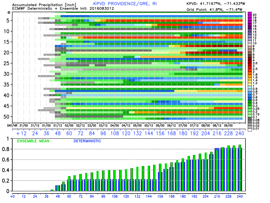
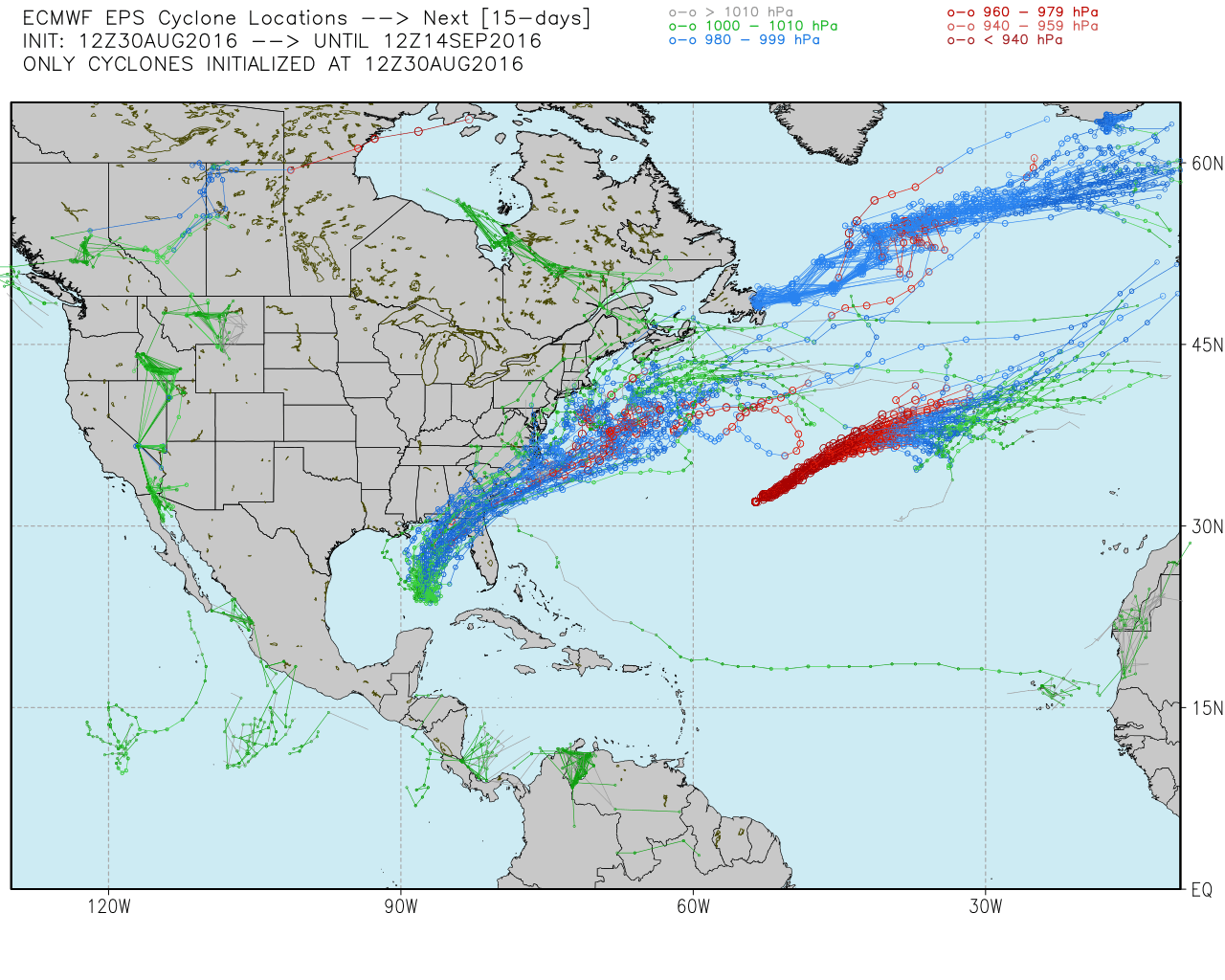
The forecast for Tropical Depression 9 is uncertain. There was a lot of Twitter buzz on Tuesday after models shifted closer to the East Coast, and the European model had the storm do a loop back towards New England when it runs into a ridge of high pressure over Eastern Canada. At this point, I would not even be in “prepare to prepare” mode for a tropical storm early next week. I think the most likely scenario is the storm stays at sea, but it bears close watching in the coming days.
The Labor Day weekend looks dry and pleasant, with highs in the 70s to near 80, and lows in the 50s.