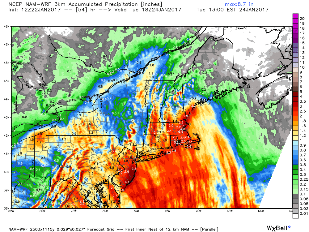
A strong wind/rain storm will bring a soaking to Southeastern New England early in the week. Gusts over 60 mph are possible on Cape Cod and the Islands, with 50 mph gusts possible near Buzzards Bay and the RI coast. The strongest winds are expected late Monday.
Drizzle and mist may develop Sunday evening, and it will linger into Monday morning ahead of the storm that will bring heavy precipitation late Monday into early Tuesday. Expect a damp and breezy Monday morning, with increasing winds and steadier rain bands arriving at the coast late in the day. Rain will be heavy at times Monday night into early Tuesday. Coastal flooding and beach erosion is possible Monday night. The heaviest rain ends early Tuesday, but it will stay damp with some showers and drizzle through the day. Highs will be near 40 on Monday, and in the low 40s on Tuesday. 1-3″ of rain is likely in Southeastern New England, which is good news for the drought, but not great for anyone traveling Monday night.
The weather will be quiet in the midweek into next weekend. Highs will stay in the 40s Wednesday through Friday with dry or mainly dry skies. It will be mostly cloudy at times, but relatively warm for late January. Seasonably cold weather returns next weekend. Expect highs in the 30s Saturday and Sunday with dry skies.


