The first 10 days of September averaged cooler than normal, the second 10 were warmer than normal, and most of the rest of this month will continue that warming trend. Fall arrives at 4:02 Friday afternoon, but it will feel more like summer this weekend into, at least, early next week. What happens with Jose and Maria will decide whether it stays unseasonably warm through the middle of the week.
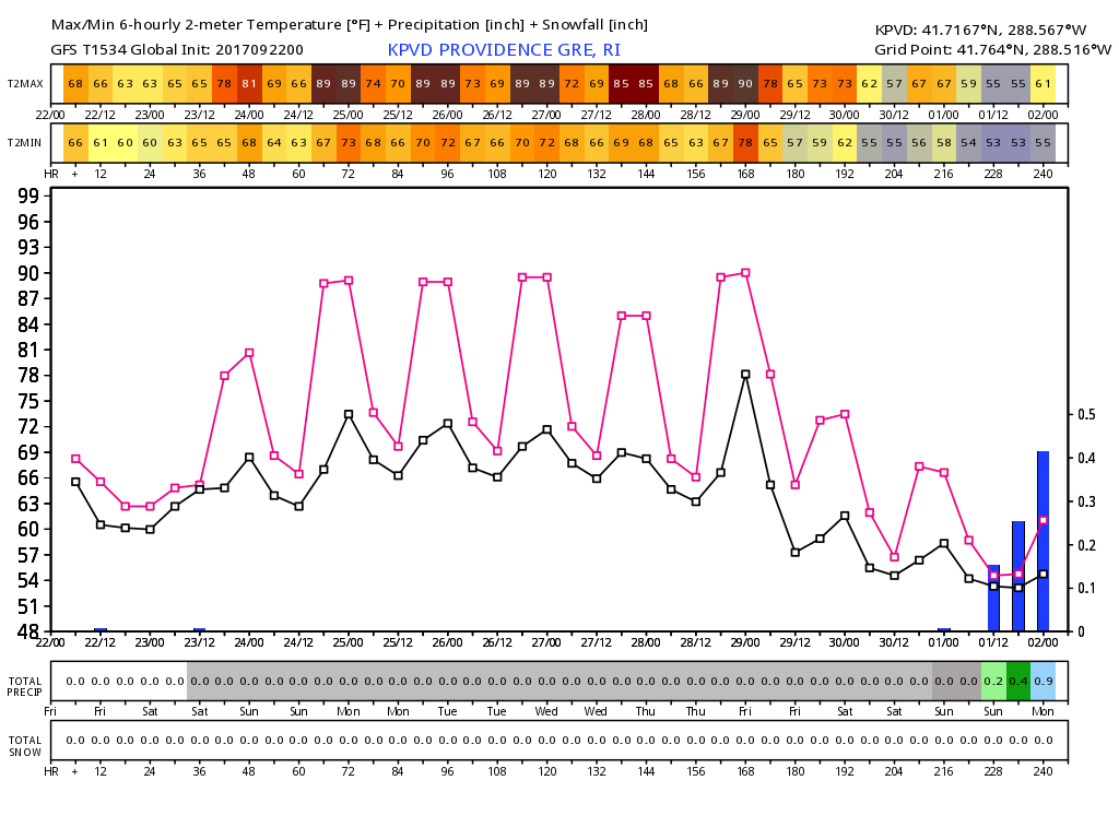
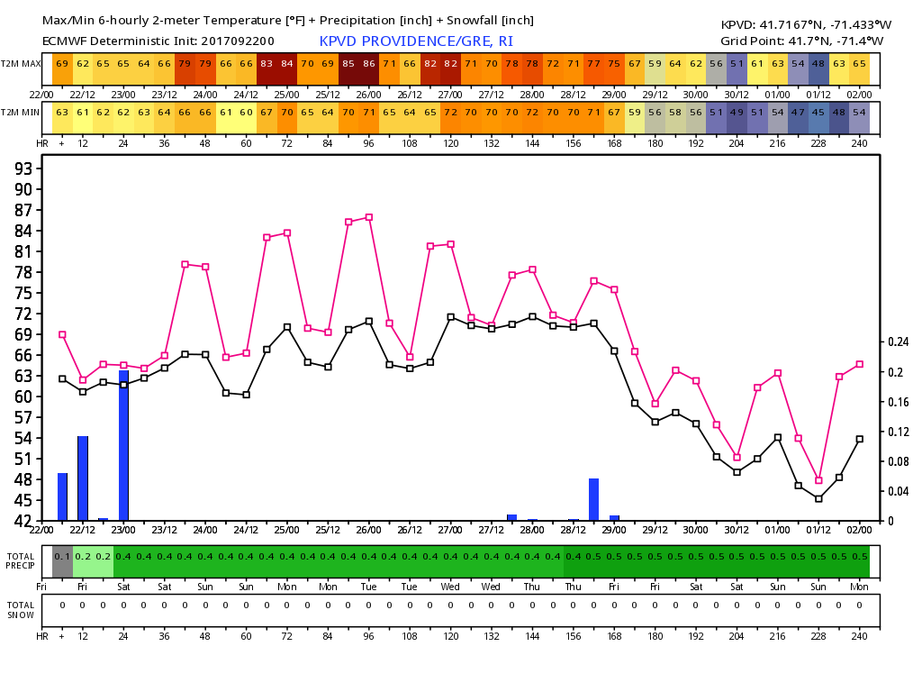
There will be some humidity with the unseasonable warmth. It will not quite feel like the Dog Days of Summer, but you’ll notice a bit of mugginess this weekend through the middle of next week. The record high temperatures in Providence are close to the projected high temperatures between Sunday and Wednesday. Sunday may be the most vulnerable record.
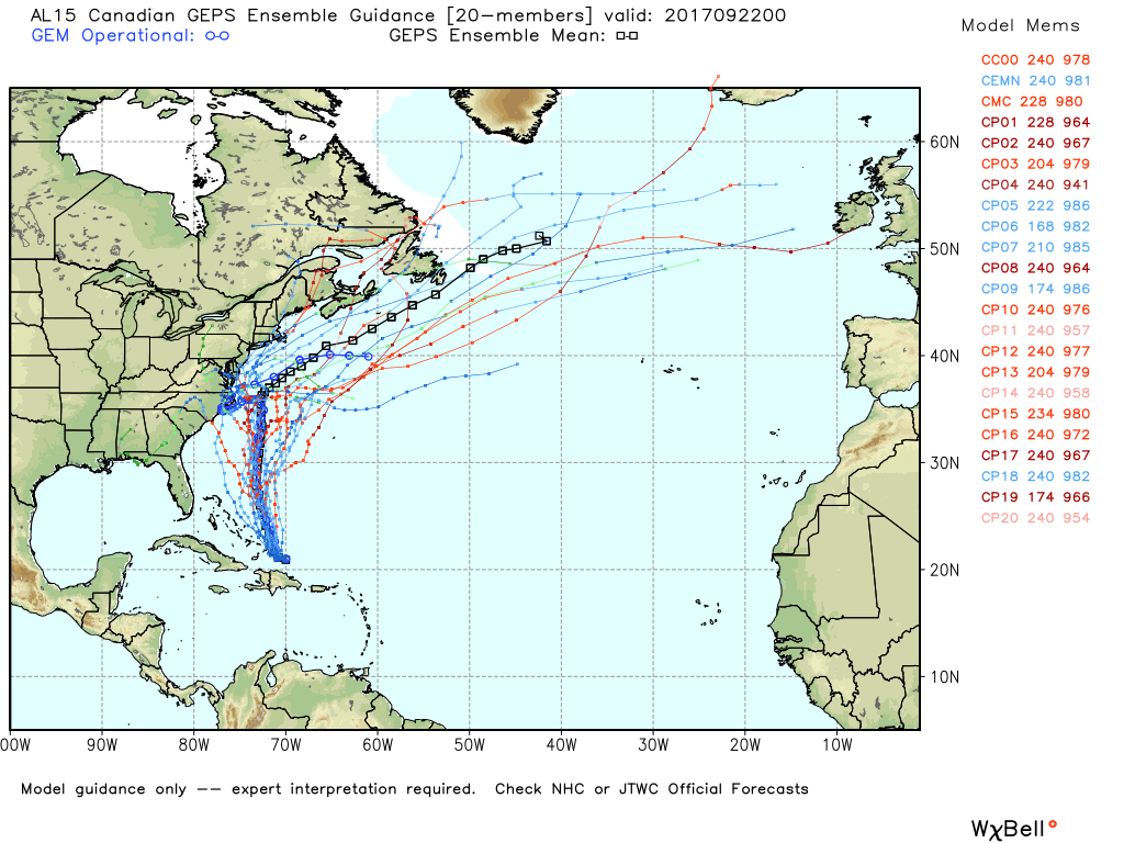
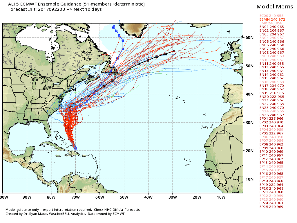
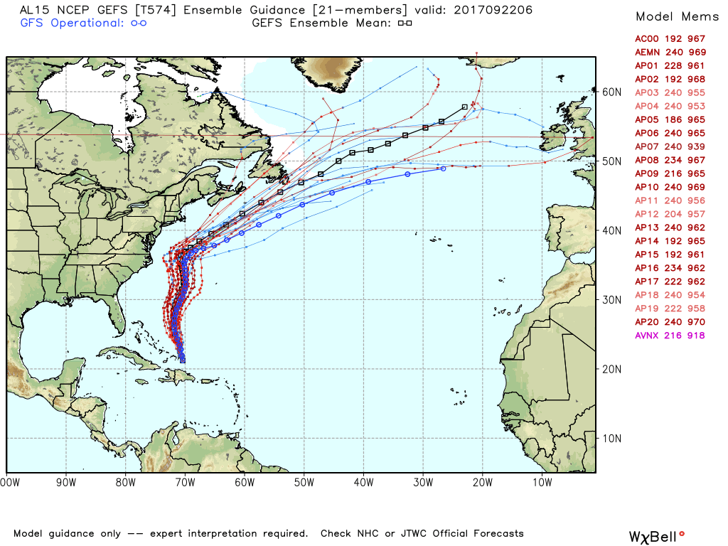
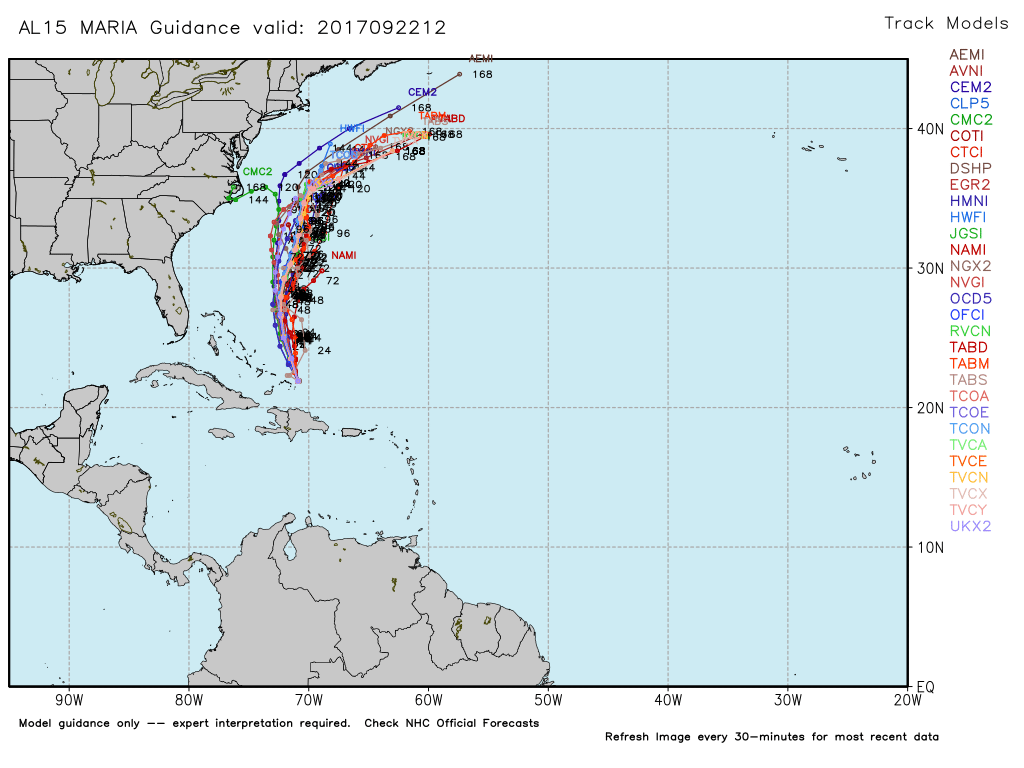
Maria is a category 3 hurricane as it moves east of the Bahamas on Friday morning. The storm will move northwest then north. There will likely be a wiggle in the storm’s track as it moves north off the Eastern Seaboard. The models disagree on how big the wiggle is, and that’s why there are still some projections that bring the storm close to or into the Mid-Atlantic coast next week. The wiggle comes courtesy of interaction with what’s left of Jose. I think that there’s enough of a wiggle in Maria’s track that we’ll know it’s in the Atlantic Ocean as it passes by Nantucket in the mid to late workweek. I do not expect the track to be as close as Jose was, but there will be a breeze and possibly some mid-workweek showers as Maria interacts with Jose’s remnants. Heavy rain is unlikely, and the mainly dry pattern most likely continues through next weekend. Expect a cool shot for the weekend, but it’s probably not going to last.
There’s a decent chance that a storm forms along a front over the Southeastern United States early next week, and that may bring rain to RI and SE MA between Monday and Tuesday.
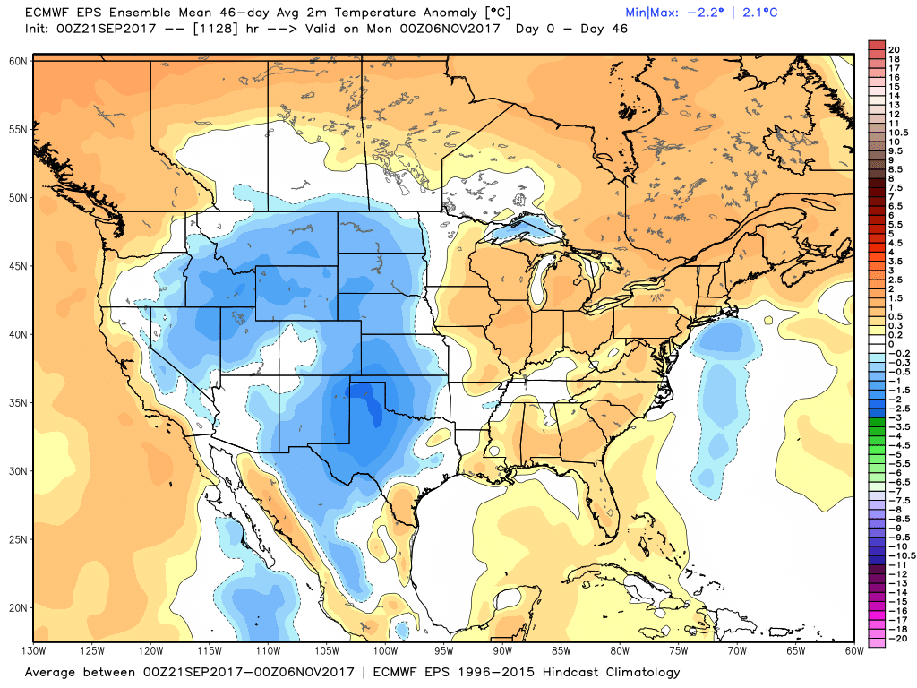
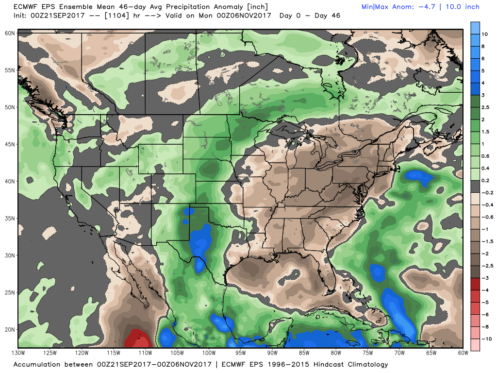
The new Euro weeklies are out, and they continue a warm/dry trend in most of the Eastern US through the end of October.