February has not exactly been a quiet month weather-wise. Sure it’s been incredibly mild, but it has also been fairly active with nearly half the days providing more than a trace of precipitation in the Providence area. If there was not another drop of rain for the rest of the month, Providence would have 128% of the normal monthly precipitation. There will, however, be more rain on Friday, and again on Sunday, which could be enough to push the rain total for the month to more than 5 inches.
For the rest of the month, on the days it does not rain it will be rather mild. Highs will be near 50° Saturday, Monday, Tuesday and Wednesday. Most or all the daylight hours on those days will be dry. The normal high for the rest of the month is 42-43°, so low 50s is doing pretty well. There’s a good chance that this month finishes as the warmest February on record in Providence, and it will be in the top-5 in Bridgeport, CT, and top-10 in Boston, MA.
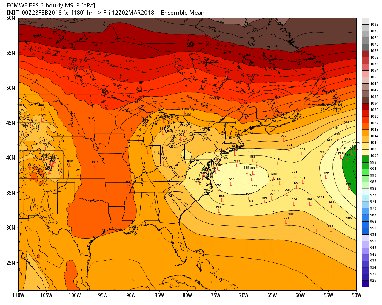
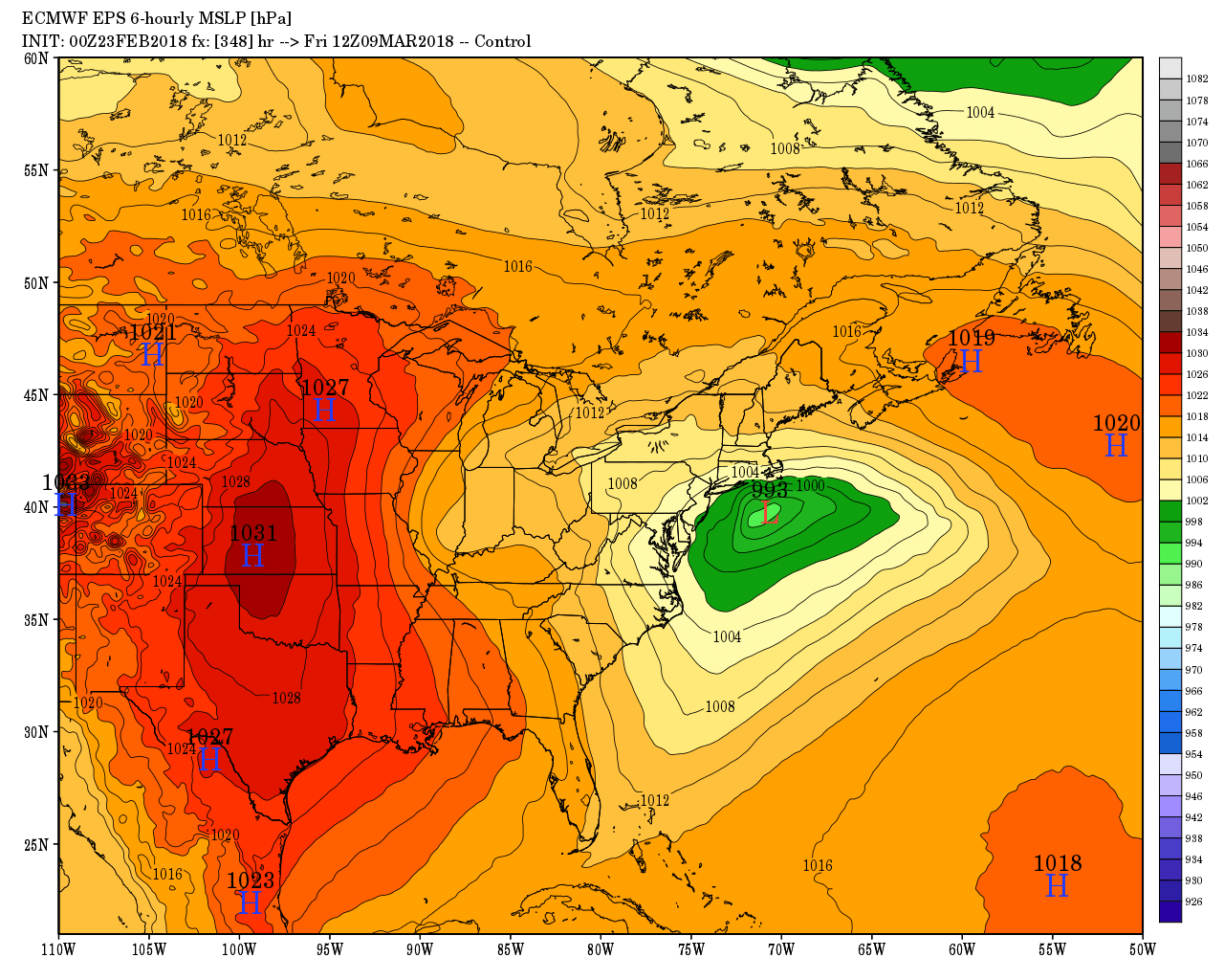
The weather action likely picks up late next week as March comes in like a lion. There is a good chance that a storm in the Mid-Atlantic or Northeast that brings rain, snow or both to Southern New England Thursday and/or Friday. It’s way too early to speculate about the precipitation type. The storm’s track is quite uncertain, and it could come close enough for all rain or stay far enough away that it brings just light snow/mix. Coastal flooding, especially in Eastern Massachusetts, is also a concern because it could be a slow-moving system.
The EPS weeklies suggest that it will be a rather active March for storms in the Eastern United States. It does not look especially cold, but an active storm track in March could bring snow/mix events at least through the middle of the month. Slow-moving areas of low pressure could break a couple of ways for Southern New England depending on the tracks. If they stay away, we could have extended stretches of dry weather. Conversely, if they’re stuck nearby, we could be looking at long-duration storms that bring rain/snow/wind.