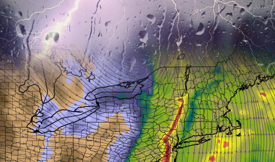
The weekend is starting out with some tropical humidity in Southern New England. The dew points are near 70°, and the air is chewy. A strong cold front will move into the Northeast today, bringing with it strong to severe thunderstorms. The best chance of seeing severe thunderstorms, with a main threat of damaging wind, is in NY, PA, NJ, W CT and W MA.
There will likely be some fog to start on Saturday. It should burn off to partly to mostly cloudy skies. The wind will increase by late morning to 10-20 mph, and we may see some 30 mph southerly gusts during the afternoon. Highs will be between 76-82, with the cooler reading at the coast.
A few renegade showers may develop ahead of the main squall line. Those showers should move quickly from south to north, and may pop-up anywhere in Southern New England throughout the day.
The main event should reach New York City, Western Connecticut, and Western Massachusetts around sunset. Those storms, fueled by a strong jet stream, very humid air, and a lot of vertical wind shear, will continue moving east through the night. I expect the storms to weaken some as they approach the maritime air over Rhode Island and Southeastern Massachusetts, but I can’t rule out the possibility of seeing a storm strong enough to bring damaging winds over 50 mph. The best chance of this happening is in E CT, W RI and Worcester County. It’s something we’ll have to monitor closely tomorrow evening.
The strong t-storm / heavy rain threat ends by mid-morning Sunday. We’ll see a blend of clouds and sun Sunday, with gradually falling humidity. Much drier air settles in early next week.


