An energetic weather system promises to bring some strong winds and heavy showers to New England Tuesday into early Wednesday. The southerly wind will increase during the day Tuesday, with some gusts over 30 mph likely during the afternoon. The worst MA and RI weather is likely late Tuesday night as a cold front barrels through with a howling southerly wind ahead of it.
Damaging wind potential
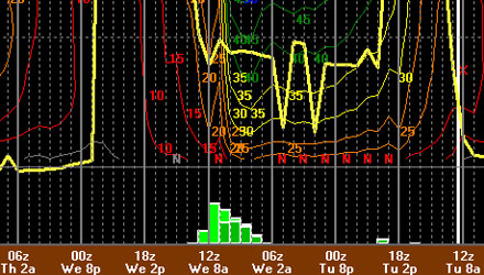
The wind will be screaming between 60-80 mph about 2,000-3,000 ft. off the surface. It’s possible some of those strong winds – close to 60 mph could briefly reach the surface, although, I think most will see maximum wind gusts in the 40-50 mph range. The peak winds are likely to occur between late-evening Tuesday and dawn Wednesday. The strongest winds will be out of the south.
Severe Weather Potential
The Storm Prediction Center has RI in a 5% risk of seeing a tornado within 25 miles of any given spot. That is an indication of how vigorous the approaching system is, but there is still a 95% chance of not seeing a tornado through tonight as the system passes. The best dynamics, and highest likelihood of tornadoes, is over the Mid-Atlantic. There is a much better chance of seeing the aforementioned strong straight-line winds in RI and SE MA.

Rain – Thunderstorms
Scattered showers are likely Tuesday as a warm front punches through Southern New England. The best chance for steady rain Tuesday afternoon is in CT and Central/Western MA. A line of heavier showers and embedded t-storms will come through between late Tuesday evening and about 7AM Wednesday morning. Most will likely pick up at least 0.5″ of rain from this system. Some places in RI and SE MA could pick up 1″+. The highest rain totals in New England, likely 1.5-3.5″, should be in W CT, W MA, and VT.
Wednesday weather
After a wet/windy start, the weather should improve quite a bit during the day Wednesday. The early-morning commute could be slowed by gusty wind and heavy showers, but the line of heavy rain will be moving through Eastern MA by mid-morning, and it should be offshore by noon. RI will see some breaks in the clouds – especially in the afternoon. The wind will diminish after the rain ends, but then pick up to 10-20 mph in the mid-afternoon as drier air moves in behind the system. The temperature should be in the upper 60s to start the day, and reach the low 70s in the afternoon.


