MobileTropical

Fred Feed – Friday Sandy Live Blog Updates

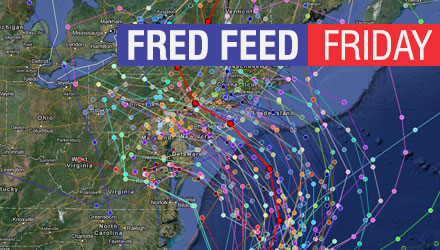
Check this page often for live blog updates on Friday, October 26, from Right Weather meteorologist Fred Campagna.

Feel free to ask questions in the comment section near the bottom of the page.

RightWX App users – click here: http://bit.ly/fred-feed-friday

Fred Campagna

President and Chief Meteorologist - Right Weather LLC AMS Certified Consulting Meteorologist #756 AMS Certified Broadcast Meteorologist #126

Related Articles

44 Comments

  1. With every new “cone” put out it seems that the center is forecast to be more to the south. For the people south of that direct hit will this be not as bad as the people north of it? Also I know forecasts change all the time, when will all of us along the east coast know when this is the true forecast, so we can start preparing?

  2. In your opinion Fred, what model would you trust the most, the Euro model or the US model since they show a wide contrast in tracks, or would you look for something in between! And if the Euro track pans out, would we still tropical storm conditions?

  3. Fred,

    You mentioned previously that you had been discussing with colleagues the the models’ projections of wind speeds and pressures – and how they didn’t seem to line up with one another. I believe that was around 12-18 hours ago; how are things looking today? Have the models changed, or, have you received any feedback as to which (wind or pressure) may be difficult for the models to handle and thus inaccurate?

  4. A Boston Globe writer said this morning: “We won’t miss the storm, but the impact of the storm could be quite minimal, think big rainstorm.”

    He also tweeted that for MA “Track projection is into NJ now and that gives us moderate rain nor’easter.” Do you disagree? It seems as though this writer is discounting the GFS and its ensembles.

    The article is confusing because it uses terms like “minimal”, “good news”, “big rainstorm”, etc, but also tells people to prepare and warns of significant impacts. I don’t know if those mix well.

    Here is the article/source: http://www.boston.com/news/weather/weather_wisdom/2012/10/sandy_will_hit_atlantic_coast.html

    1. Sorry to be a pest but if the front that is coming off the coast to push Sandy east, if it is a little stronger and pushes it out further than expected, wouldn’t it force Sandy a little further north?

  5. Some sources are calling this a “Frankenstorm”, and have Sandy merging with some Arctic air and another storm system in the west. Any comments?

  6. We are looking at the schedule for our weather based business- trying to decide whether it will taper off on Tuesday so we can do some photoshoots! Any thoughts?

  7. The Euro model seems to have been a bit more consistent with what is happening than the GFS model. While you can’t just dismiss the information it’s providing, at what point do you rule out the data a model provides if/when it’s been all over the map leading up the event? Specifically, how much credence can you give a model that is showing a path so close to us when it’s been less accurate than others to this point.

  8. Hey Fred- I have 4 little ones. What are your thoughts on 1- school cancellation Tuesday and 2- Trick or Treating Wed?
    Thanks!

  9. Fred. Taking into account that both the latest Nam and GFS models have shifted slightly north do you expect the Euro to follow suit? It is starting to get closer to crunch time.

  10. Just noticed a recent Tweet from Cantore about the possibility of Sandy hitting RI first, then looping back down to NYC. Scary stuff – what are your thoughts on that track? Out there??

  11. If Sandy gets pushed east a little further by the approaching front, won’t that tend to bring the storm back further north?

    1. Sandy has multiple steering factors in the next three days. Right now, it’s a little shortwave that is bringing it slightly northwest. If it ends up farther east when it gets to the same latitude as North Carolina, then it is likely to take a wider turn and hit the US farther north.

  12. Hi there, I was wondering what the possibilities are for Sandy to be a problem in Newfoundland?

  13. Does the 2pm update change the track at all or increase likelihood of stronger impacts for RI?

  14. Hi Fred – Do you think that the European model is becoming more of the outlier than the others in terms of strength and path? The most recent model has it taking a very weird path with a sharp turn west into New Jersey, and as you posted in your photo, much farther east than before. Seems like something isn’t quite right with those projections… your thoughts? Keep up the great work!

    ~Ted

  15. How do these track changes compare to Irene’s track at this time in it’s progression up the coast? I seem to recall similar trends on the track in the models, bringing it closer to a direct hit and then it ended up staying south….

  16. Fred- Thanks so much for this blog and for answering all of our questions. I have never been one to follow weather, so all of these models you reference I know nothing about. You’re watching all of them, but which one historically has proven to be the most accurate? Also, I have noticed businesses already starting to close for Monday. When she we prepare for schools to start closing? Monday or Tuesday?

  17. Fred, when do you think that it will be possible to get storm surge estimates for the bay? Is that something that the NWS will produce – and how much would the flooding vary from say mid-bay (Portsmouth) to the top of the bay (Providence) as the water stacks up?

    1. Krissy, a storm like this will not spawn strong tornadoes. Sometimes, in a tropical system there can be weak tornadoes, but since this will be a post-tropical system, it’s very likely to bring us only strong straight line winds.

  18. This question is about the “18z” GFS model, which came out at about 6pm. I realize it is just one model/projection and not an official forecast, but I was still wondering about the impacts and implications of it.

    While the storm doesn’t head NW from long island, it looks to scrape the coast and head towards Trenton NJ – almost due west. Is this run of the GFS (that is, if it ends up verifying) still considered a “worst case scenario” as you laid out in your graphic earlier today?

  19. Hey Fred!, Irene spurred a confirmed tornado that ran from quonsett up through Quidnessett here in North Kingstown. What needs to happens in the atmosphere during this storm for this to happen?

Back to top button