Extreme WeatherTropical
Fred Feed – Thursday Sandy Live Blog Updates
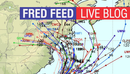
This will be a great resource for those who are not on Twitter to get all of Right Weather Meteorologist Fred Campagna’s updates leading up to and during the storm. Bookmark this page and check back often on Thursday for the latest.
For south NJ, how bad do you think it will be? Can you see the power being out for a weeks time or more?
Ray, the current projections put south NJ in the bulls-eye. There are still three to four days before the storm arrives, but based on the current forecasts, power could be out for a while in some places. Of course, it’s impossible to predict exactly where the power will go out and for how long it will stay out.
I haven’t heard anything more about the Nor’easter combining with Sandy. Is this no longer the case?
Joe, that’s no longer the case. It’s purely Sandy that is heading for the Mid-Atlantic or Northeast.
I kept hearing on HLN/CNN that there looked to be a possibility of snow that would join with Sandy…not sure what your takes are on that.
Daniela, based on the current tracks, the best chance of that happening is in the mountains of West Virginia as colder air wraps around the storm.
Fred….I have read that this storm will likely stick around for a few days, is there any merit to that?
Tracy, the Northeast will feel impacts of the storm for at least 2-3 days. Some computer models stall it over the Northeast, and although it will be weakening, there will still be wind, rain, and on the western end of it, possibly some snow.
Thanks Fred!!!
Fred, I’m pretty confused. Why is there only a 25% chance of tropic force wind. I figured this was a given since there’s been so much talk on how bad of a storm this could be.
Rob, if the forecast does not change, you will see that number gradually increase as the storm nears. 25% for a storm that is four days away is quite high. So far, a lot of the talk (from my end) on the storm has been based on potential. The track was very much in question yesterday, and there is still a 400 mile range among the models.
Thanks Fred!
So we have a group running the MCM on Sunday in Washington DC. We fly out tomorrow and are presumably flying home on Monday morning. Current plan now is to rent cars and DRIVE home on Sunday late afternoon early evening….good plan or bad plan? I know there will be many runners (30k!) trying to get out of dodge so to speak – so a little worried about traffic up through the East Coast Sunday night into Monday Morning…should we be worried? Need to make a decision about going to race by tomorrow morning!
Nicole, that’s a close call! If some models are correct, the weather will already be heading downhill in DC on Sunday morning. Based on the current track, a flight out of DC looks shaky (no pun intended) Monday morning. I like the idea of driving back better.
Thanks Fred! Do you think we would be ok to drive home Sunday leaving around 4pm?
Right now, yes. The timing of the storm could change by 12-18 hours by then, so stay on top of the forecast.
Hi Fred,
If Sandy hits NJ, what kind of impacts will be felt in Providence?
I have an infant so I want to be fully prepared if it will be bad around here.
Thanks in advance!
Karen, NJ is 100+ miles from north to south, so it will depend on what part of the state it hits, but, assuming it hits in the middle, I expect tropical storm force winds here, along with some rain (probably not flooding), and a lot of coastal flooding and beach erosion. The end result as far as the wind goes, may be similar to what Irene did last year. The coastal flooding would be worse.
what impact may rhode islanders get and southern mass get if it comes closer to NYC. and another question? also what impact could you be looking at in Camden NJ my kids live out there and im in RI, i wanna know and not be worried or at least prepare them for the worst.
Santos,
Closer to NYC means a bigger impact in RI and S MA. At least strong tropical storm winds, maybe hurricane force. Coastal flooding, some heavy rain bands, but probably not enough rain for street, river, or stream flooding. In Camden, NJ, the wind threat is similar, with some damage likely, and potentially a lot of rain – more than we’ll see in RI and SE MA if the storm heads that way.
I keep listening to the weather channel and they are saying that this storm is historical. Why is this storm different than any of the other hurricanes that have passed through here? Thank you in advance for your answer!
Answered above in live blog.
Do you think the models will continue to trend south or are there any indications that a wobble back to the north is a possibility?
Answered in live blog.
Thanks Fred. How is the euro’s track record with tropical activity?
Do you see any possibility of tornados being spawn from this storm?
Hi Fred,
What do you think the pressure will get down to on landfall? Some of the models are showing scary numbers!
Answered in live blog
One more question if you don’t mind, any idea what’s going to happen for Halloween? Should us parents prepare the kids for a “possible” no go?
Hi, Fred!
I’m doing my normal shopping tomorrow, gassing up the cars, and all. (The husband is an eagle scout.) 😉 But when will we know if this is a “Monday’s commute is gonna suck” storm or a State of emergency kinda storm?
I live in North Western Virginia, about an hour outside of D.C. How much of an impact will we feel in this area? Do you think the future models will have the storm coming in south of New Jersey? Great site – just saw it today and am a huge fan. Any insight you could give would be greatly appreciated!
Thanks,
Emily
Emily, There will likely be a significant impact in your area, but not as bad as will be for those closer to the coast. Tropical storm conditions are possible where you live. It looks like the models are zeroing in on a track that is in Southern New Jersey, but, this far out, there may be an error of 150 miles in either direction. Thanks for checking out the site!
Fred, I live in RI but out in California for work. I had a return flight on Monday coming back to Providence, but worried I’ll get stuck. Do you have any advice on the best way to try and make it home in time? My options are to take Sunday night red eye to Newark and then fly to Providence. I’m thinking of taking a red eye to Boston instead. Which city would you place your bet for best chance to make it hOme. Boston or Newark?
Jamie,
I would take the red eye to Boston. It is one fewer flight, and to an airport that is farther north away from the impacts of Sandy early Monday. It may be quite windy in Boston by dawn Monday, too, so there’s no guarantee you’ll make it.
I fear that the “hype” of Irene that ended up not materializing have folks really downplaying the potential damage and effects of this storm.I hope by tomorrow morning we will know what preparations to make. Someone needs to make the seriousness of this very clear at some point.
Answered on the Friday live blog: http://rightweather.net/2012/10/fred-feed-friday-sandy-live-blog-updates/
Hi fred do u think there is going to be a state of emergency? And what day is going to be the worst of the storm?
You’ll have to ask the Governor about the state of emergency. It’s certainly possible. Monday to early Tuesday is probably the worst of it.