6PM
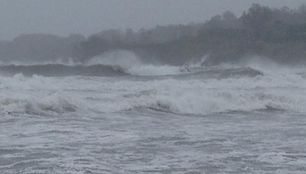
The storm surge is already inundating some low-lying areas and high tide is not until about 830 pm. This is likely to be the worst coastal flooding event in decades.
430 pm update
A burst of stronger winds will occur in the heavy showers that developed around 4 pm and are quickly moving inland. Some wind damage is possible in widespread 60 mph gusts. For inland locations, these wind gusts will likely be the strongest of the entire storm.
From 2pm
This will be the spot for any critical updates during the remainder of Hurricane Sandy. If you want more in-depth analysis along with some additional photos, etc., the Live Blog is available for Right Weather Pro subscribers.
Sandy is intensifying to record levels. As of 11 am the storm had a central pressure of 943 mb, breaking the old record for any storm north of North Carolina. The old record was held by the Hurricane of ’38 as it passed Long Island. Sandy should be even more intense on landfall in New Jersey this evening.
Peak winds of 80+ mph are posible near the coast. The winds will be stronger than a couple of thousand feet off the surface, and the atmosphere may be mixed up enough to transport some of the hurricane-force winds to the surface. Obviously, 80 mph winds will cause widespread damage. It will be a very close call between receiving 65-70 mph winds and 80-85 mph winds for those near the coast. The timing on the peak winds is about 1-5 pm.
There was a moderate storm surge in many places at the time of Monday morning’s high tide, and the storm surge will be even higher this evening. High tide near Buzzards Bay and the coast of RI, including Narragansett Bay is at roughly 9 pm. Use extreme caution this evening if you are near the water. The flooding may be worse near the coast than many of us have ever seen in some spots. Normally safe locations may become inundated. Always follow the advice of emergency personnel.


