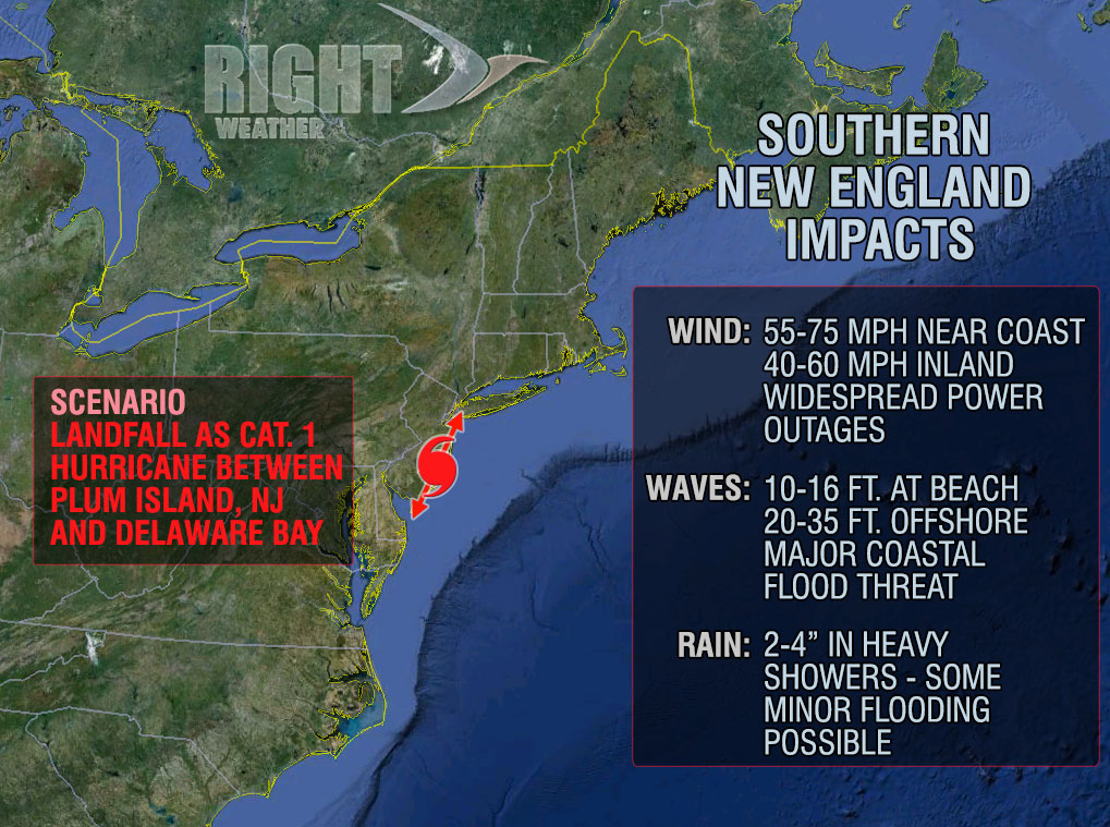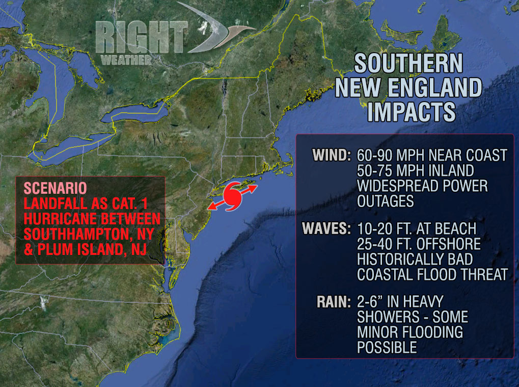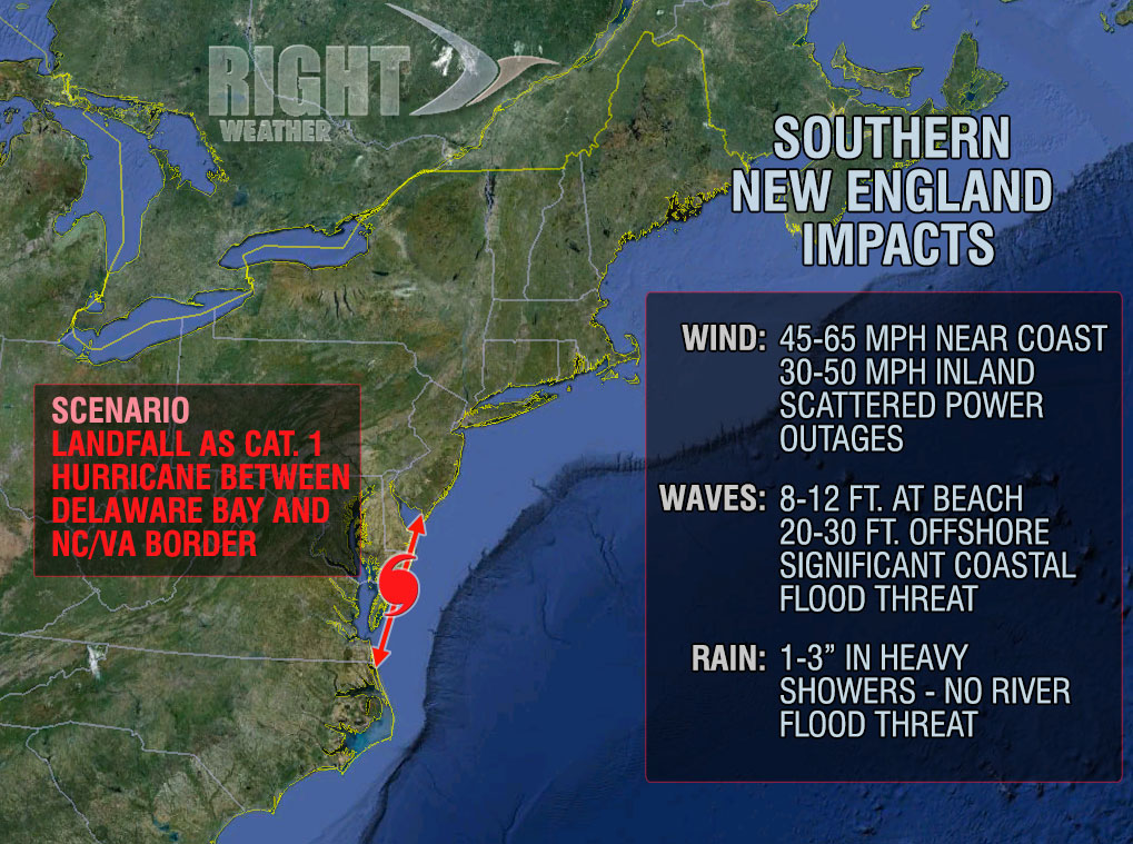
Hurricane Sandy is very likely heading to the Mid-Atlantic or Northeast coast early next week. While the exact track remains somewhat uncertain, we have been able to narrow the focus considerably in the past two days. Check out the graphics below (click to enlarge) for the storm’s impacts in Southern New England based on the different track scenarios. All three scenarios are based on the National Hurricane Forecast of Sandy being an 80 mph hurricane at landfall. In any scenario there are significant impacts in Rhode Island, Massachusetts, and Connecticut – especially near the coast.
All three scenarios are still in play. The northern most (worst-case) scenario for Southern New England is the least likely track right now.
Get the latest on the storm by checking the Fred Feed Live Blog on rightweather.net
You can also follow @fredcampagna and @rightweather on Twitter.
It’s also a good idea to download the FREE Right WX app for Android and iOS devices.