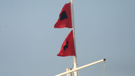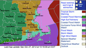
For the better part of a week we have been telling you about the potential for Hurricane Sandy to strike the Northeast United States. As my forecast has gone from probably not to maybe to probably to highly likely, you would expect to see the National Hurricane Center issuing Tropical Storm and Hurricane Watches for the Mid-Atlantic and Northeast with the storm’s impacts arriving in about 36 hours. Well, they’re not up yet, and to paraphrase former Celtics and Providence College Coach Rick Pitino “Hurricane Watch and Tropical Storm Watch are not walking through that door!” The National Hurricane Center and National Weather Service have made the decision to not issue tropical-related warnings for areas north of where Hurricane Sandy is making landfall.
Frankenstorm nature of Sandy causes watch/warning change
As you know, Sandy is not your typical hurricane, some have taken to calling it Frankenstorm because it is expected to transition from a hurricane to a post-tropical / extra-tropical storm when it interacts with the jet stream (which will strengthen it, by the way) and gets drawn to the north then west. As a result, the brain trust at NHC thought it best to not “confuse the public” by issuing tropical storm and hurricane warnings for a storm that was not going to be purely tropical when making landfall. So, instead, we’re going to see a cut and dried combination of High Wind Watches/Warnings, Coastal Flood Advisories/Watches/Warnings, Gale Watches, Storm Watches, Flood Watches, High Surf Advisories, and Tropical Storm Warnings and Hurricane Force Wind Watches/Warnings – but those will only be over the water.

In a situation like this, some of those watches and warnings would be issued in addition to the hurricane and tropical storm watches and warnings, but, without the headline grabbing “Hurricane Watch” or “Tropical Storm Warning”, I fear that people will not take this storm seriously, or, at a minimum, just be thoroughly confused about what to expect. I think the NWS and NHC is asking too much of the general public to try and decipher what all the different warnings mean. I’m sure that you, like most of us, have a lot going on, and hearing Hurricane Watch or Tropical Storm Watch instead of High Wind Watch is more likely to make you pay attention to what is coming next. We have High Wind Watches/Warnings several times a year, in my opinion, it doesn’t quite grasp the gravity of the situation. I think the NHC would have been much better off to put their PhDs in the desk drawer, forget about the science lesson, and do something for the benefit of safety and effective communication at the expense of perfectly sound science and adhering to a policy that probably needs a little tweaking at this point.
The bottom line is this. We have a strong tropical storm or hurricane coming. Prepare for this storm the same way you did, or wish you did, for Hurricane Irene. If you live near the coast, this storm will likely be worse in terms of wind and flooding than Irene was. For those who say “If you’re going to use tropical warnings for this storm, why not issue them for every massive Nor’ester with 50-70 mph winds?”, I say that’s taking your argument a little too far. The storm has been referred to as Sandy for a week now, everyone knows it as a hurricane. Hoisting hurricane or tropical storm watches and warnings just makes sense to the tens of millions of people in the path of the storm. It’s a unique storm that calls for bending the rules.


