There are a handful of computer models that we can analyze and dissect two to four times a day as they roll off the presses. The Canadian and NOGAPS are not my go to models, but they are worth looking at in a scenario like this.
Canadian Model
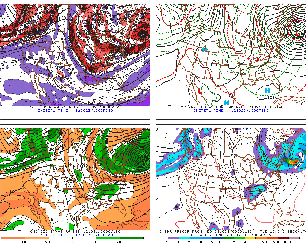
The Canadian model was one of the first models to slam Sandy as an intense storm into the Eastern United States coast. As of Monday morning, the model (fig. 6) was projecting a dire scenario for the Mid-Atlantic and Northeast. It started to trend away from that last night, and this morning it flat out bailed. The 12Z Canadian model takes the storm hundreds of miles off the East Coast (fig. 7) before pulling an 18Z GFS and pinwheeling it back to the NW and scraping Eastern New England (fig. 8) with wind, rain, and waves. In this scenario, the brunt of the storm is Tuesday. With the storm far enough offshore, the wind would likely not be damaging, and the rain would probably not cause flooding, but the storm’s circulation, combined with several days of N or NE winds would likely lead to coastal flooding and beach erosion.
[threecol_one]


NOGAPS Model
The NOGAPS has been kind of a dark horse in this race. I’ll be the first to admit that it’s at the bottom of my box of forecasting tools. This time around, the model has been consistently bringing a major storm, similar to the ECMWF (and the Hurricane of 1938) to Long Island. One of the major differences between the NOGAPS and most other models is how tight it stays to the coast (fig. 9) compared to all other models. It moves the storm from the Western Bahamas to the Twin Forks of Long Island at 8AM Monday. If the NOGAPS verifies, you can expect a monster storm to start the workweek.

Thoughts on the models
If computer models had Olympic games, neither of these models would regularly take home medals, but, they both seem to have the right overall idea with this system. The NOGAPS is a little too far west, and probably too intense with the storm as it moves up Gulf Stream. Ultimately, it turns Sandy to the northwest, which will likely happen at some point with this storm, and the NOGAPS chooses to do it at a point that would wreak havoc in the Northeast – particularly Long Island and Southern New England. The Canadian flip-flopped big time on the consisten solution it had shown for several days. It’s newer scenario of the storm staying well offshore then being forced back to the northwest upon encountering the strong ridge is plausible, but I think it has gone just a bit too far east before taking the turn back to the northwest.


