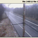
A rain/snow mix has been falling for areas south of Providence since mid-morning. It has been mainly snow west and north of I-95, but the snow hasn’t accumulated much due to the temperature being in the mid 30s. A transition from mixed precipitation to snow is likely from the coast to Providence by sunset, and some light to moderate snow will continue this evening. The best chance of accumulating snow remains in the western part of Providence and Kent Counties in RI, as well as all of interior CT.
The steadiest snow will be between 4 pm and 10 pm in Rhode Island. A mix of rain/snow or some light snow will fall in SE MA until about 2 am before tapering off to flurries. The temperature will fall from the low to mid 30s to the upper 20s to low 30s by dawn, so untreated surfaces may become slick. Wednesday should become partly sunny, but stay cool, with highs in the upper 30s to low 40s. More cold, dry weather is in the forecast for later this workweek.
The accumulation map has been adjusted slightly to focus the best chance of 2+” of snow in Providence and Kent Counties, and most of CT. It does not look like there will be more than 2″ elsewhere in Southern New England.


